Search
Search Results

Image
Soviet War Memorial in Berlin
Soviet War memorial in the Großer Tiergarten, Berlin, photographed by Manfred Brueckels, 2007. The memorial itself was unveiled in November 1945 to commemorate the Soviet Union's losses in the war, especially those who died during the Battle...

Image
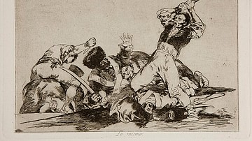
The Disasters of War, Plate 3
The third print in the Disasters of War series by Spanish artist Francisco Goya (1746-1828), between 1810-1820. Historians consider these works to have been Goya's protest to the Peninsular War and the subsequent rollback of liberal reforms...

Image
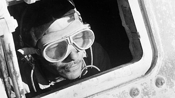
Tank Driver, Desert War
A photograph of a British Grant tank driver in the North Africa Campaign during the Second World War (1939-45). (Imperial War Museums)

Image
Europe on the Eve of the First World War, 1914
A map illustrating the situation in Europe as it teetered on the brink of World War I (1914-18). The political landscape was marked by intricate alliance systems and fierce imperial rivalries among European powers, especially between the...

Image
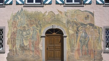
German Peasant's War
German Peasants' War (1525), wall painting by Carolus Vocke, 1965.
Herdwangen-Schönach City Hall.

Image
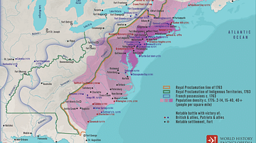
American War of Independence, 1775 - 1783
A map illustrating the course and major events during the American War of Independence (also known as the American Revolutionary War or American Revolution) between 1775 and 1783 – an armed rebellion through which thirteen of Great Britain's...

Image
The British-American War of 1812
This map illustrates the course of the War of 1812 (1812-1815), a conflict between the United States and Great Britain driven by trade restrictions, the impressment of American sailors, and disputes over territorial expansion. Native American...

Image
Map of the Roman Civil War (49 - 45 BCE) - Caesar, Pompey, and the Fall of the Republic
This map illustrates the course of the Civil War between Julius Caesar and Pompey (49–45 BCE), a defining moment in Roman history that marked the collapse of the Republic and the emergence of autocratic rule. Triggered by Caesar’s defiance...

Image
Map of the United States on the Eve of Civil War, 1861 - Free States, Slave States, and the Fracturing of the Union
This map illustrates the political landscape of the United States in 1861, just as the nation stood on the brink of civil war. It highlights the division between free and slave states, the status of U.S. territories, and the emerging Confederacy...

Image
Map of the Trojan War States, c. 1200 BCE
The Bronze Age collapse at the end of the 13th century BCE saw a great many changes in the ancient world. Many second millennium states disappeared entirely, as cities were destroyed and peoples migrated. Others underwent a process of transformation...