Search
Did you mean: Gaya?
Search Results

Definition
Djenne-Djenno
Djenne-Djenno (aka Djenné-Jeno, Jenne-Jeno, or Old Jenne) was an ancient city located in modern Mali, West Africa which flourished between c. 250 BCE - 1100 CE, making it one of the oldest cities in Sub-Saharan Africa. Prospering thanks to...

Definition
Hindu Architecture
Hindu architecture evolved over the centuries from simple rock-cut cave shrines to massive and ornate temples which spread across the Indian sub-continent and beyond, forming a canonical style which is still adhered to today in modern Hindu...

Definition
Taifa
Taifas ("factions" or "camps") were small independent Muslim kingdoms and principalities that emerged after the fall of hegemonic Muslim caliphates in al-Andalus – the Muslim-controlled part of the Iberian peninsula – during the High Middle...

Collection
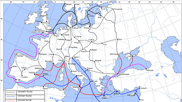
Trade in the Middle Ages
Peoples, cities and states have traded since antiquity but in the medieval period, things escalated so that goods travelled ever greater distances by land, river and sea. Great cities arose thanks to commerce and international trade such...

Video
The Rise and Fall of the Mali Empire
Did you know that at the time, the Mali Empire was the largest empire Africa had seen? Founded by Sundiata Keita in 1240, the Mali Empire became the wealthiest kingdom of West Africa and was Africa’s largest empire up to that time. The...

Article
A Visual Glossary of Hindu Architecture
Adisthana - the decorative raised platform on which a temple is built. Alasa kanya - a decorative female figure. Amalaka - a large fluted stone disc placed on top of a Nagara tower taking its form from the amla or myrobalan fruit native...

Image
Map of Ancient & Medieval Sub-Saharan African States
A map indicating the major ancient and medieval states in sub-Saharan Africa. Areas and dates relate to a state at its peak. In addition, shaded areas are approximate indicators only. For the majority of the states, their precise borders...

Image
Trans-Saharan Trade Routes
A map indicating the major trans-Saharan trade routes across West Africa c. 1100-1500 CE. The darker yellow areas indicate gold fields.

Image
Traditional House, Oualata
A traditional banco (pounded earth) house, Oualata (Walata), Mauritania.

Image
Trans-Saharan Camel Caravan
A trans-Saharan camel caravan carrying salt. Agadez to Bilma, Niger.