
Browse Content
Image
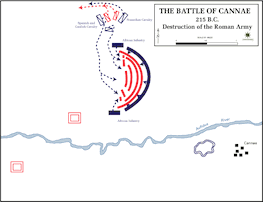
Battle of Cannae - Destruction of the Roman Army
Map of the Battle of Cannae showing how Hannibal encircles and...
Image
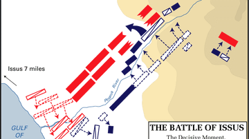
The Battle of Issus - The Decisive Moment
The Battle of Issus, the decisive moment.
Image
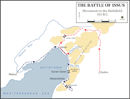
The Battle of Issus - Movements to the Battlefield
The Battle of Issus, Movements to the battlefield.
Image
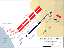
The Battle of Issus - Initial Dispositions
The Battle of Issus, Initial dispositions.

Image
Battle of Chaeronia
A map illustrating the battle of Chaeronia.

Image
Battle of Salamis, 480 BCE
The distribution of the respective fleets of the Greek allied states...