
Browse Content

Image
Map of Yuan Dynasty China
A map indicating the territory of the Mongol Yuan dynasty of China...
Image
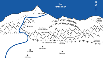
Map of the Hittite Realm
A map of the Hittite realm, as depicted in the novel Empires of...
Image
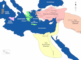
Map of the Hittite Empire and Surrounding States
A map of the Hittite Empire and surrounding states, including the...

Image
Map of the Campaigns of Genghis Khan
A map illustrating the military campaigns of Genghis Khan (c. 1162/67-1227...

Image
The Rashtrakuta, Gurjara-Pratihara and Pala Empires, Ancient India
This map shows the territorial extent of the Rashtrakuta (8th century...

Image
Gurjara-Pratihara Empire, Ancient India
This map shows the extent of the Gurjara-Pratihara, or simply...