
Browse Content
Image
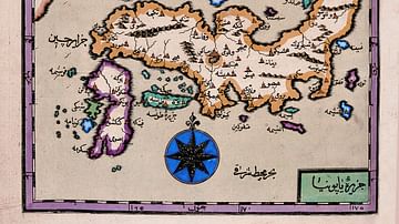
Map of Japan by Katip Çelebi
Map of Japan by Katip Çelebi (d. 1657), geographer of the Ottoman...
Image
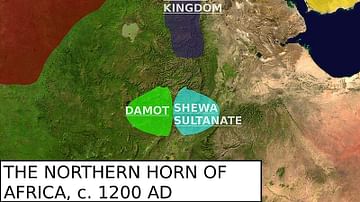
Map of the Zagwe Dynasty
Map featuring the approximate boundaries of the Zagwe Dynasty and...

Image
Map of the Phoenician Expansion c. 11 - 6 centuries BCE
The Phoenician expansion between the 11th and 6th centuries BCE...

Image
An Illustrated Map of Medieval and Early Modern Europe (From the Novel "The Jericho River")
An illustrated map of medieval and early modern Europe. From the...
Image
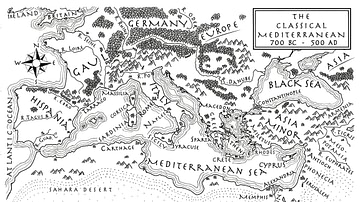
An Illustrated Map of the Mediterranean from 700 BCE to 500 CE (From the Novel "The Jericho River")
An illustrated map of the Mediterranean from 700 BCE to 500 CE...
Image
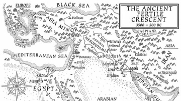
A Map of the Ancient Fertile Crescent (From the Novel The Jericho River)
An illustrated map of the ancient Fertile Crescent, 3500-500 BCE...