Browse Content

Image
Map of the Expansion of the Roman Republic (c. 260 - 30 BCE)
This map illustrates the Roman Republic's territorial expansion...

Image
Map of the First French Empire and Napoleonic Europe, 1812
The First French Empire, established under Napoleon Bonaparte (Emperor...

Image
Babylon at the time of Hammurabi
A locator map of Hammurabi's Babylonia, showing the Babylonian...

Image
Map of the French Revolution and Wars 1789-99
The French Revolution (1789–1799) also known The Revolution of...

Image
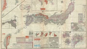
Map of the Japanese Empire, 1895
Map of the Japanese Empire, 1895. It was issued shortly after the...

Image
Map of the British Raj c. 1930
A map illustrating the British Raj around 1930, a period of direct...