
Browse Content
Image
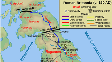
Map of Roman Britain, 150 AD
Map of Roman Britain ca. 150 AD, showing the main Roman roads...

Image
Map of Sogdiana, ca. 300 BCE
Map of Sogdiana ca. 300 BCE. (Alternate names: Sughd, Sugdiane...

Image
Map of the Successor Kingdoms, c. 303 BCE
Map of the Diadochi successor kingdoms to Alexander the Great's...
Image
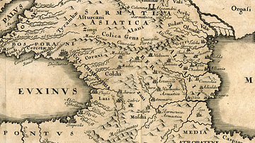
Map of Colchis
Detail from the map “Bosporus, Maeotis, Iberia, Albania et Sarmatia...

Image
Map of the Third Intermediate Period
A map showing the political divisions in ancient Egypt during the...
Image
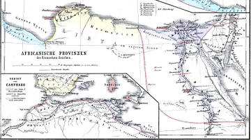
Map of Roman Africa
Nothern Africa under Roman rule. From H.Kiepert (1879), Historischer...