
Video
Related Content
Article
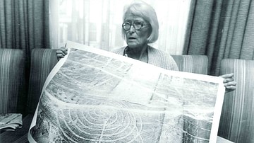
The Nazca Lines: A Life's Work
The World Heritage-listed Nazca lines are a well-known part of...
Definition
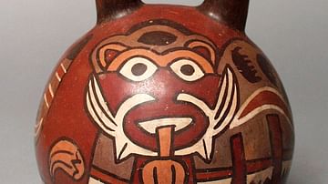
Nazca Civilization
The Nazca civilization flourished on the southern coast of Peru...
Definition
Civilization
Civilization (from the Latin civis=citizen and civitas=city) is...
Image
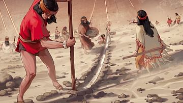
Nazca Lines Creation
Artist's impression of how the Nazca people may have constructed...
Article
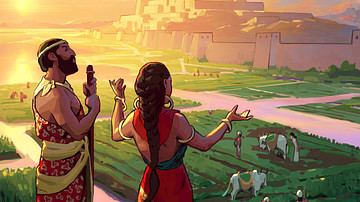
Nazca Lines
The Nazca civilization flourished in southern Peru between 200...
Definition
Cahuachi
Cahuachi, located on the southern coast of Peru, was the most important...
Cite This Work
APA Style
Kyokai, U. T. N. N. H. (2018, July 27). Lines and Geoglyphs of Nasca and Pampas de Jumana (UNESCO/NHK). World History Encyclopedia. Retrieved from https://www.worldhistory.org/video/1500/lines-and-geoglyphs-of-nasca-and-pampas-de-jumana/
Chicago Style
Kyokai, UNESCO TV NHK Nippon Hoso. "Lines and Geoglyphs of Nasca and Pampas de Jumana (UNESCO/NHK)." World History Encyclopedia. Last modified July 27, 2018. https://www.worldhistory.org/video/1500/lines-and-geoglyphs-of-nasca-and-pampas-de-jumana/.
MLA Style
Kyokai, UNESCO TV NHK Nippon Hoso. "Lines and Geoglyphs of Nasca and Pampas de Jumana (UNESCO/NHK)." World History Encyclopedia. World History Encyclopedia, 27 Jul 2018. Web. 19 Apr 2024.