
Search
Search Results
Article
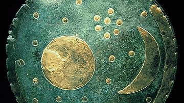
The Nebra Sky Disk - Ancient Map of the Stars
The Nebra Sky Disk is one of the most fascinating, and some would say controversial, archaeological finds of recent years. Dated to 1600 BCE, this bronze disk has a diameter of 32cm (about the size of a vinyl LP) and weighs around 2 kg. It...
Worksheet/Activity
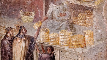
Roman Food - Map & Questions
This activity has been designed to fit a 20-30-minute slot for your class and is suitable for both online and classroom teaching. Students have to answer a few questions based on a map. It is part of our Daily Life in Ancient Rome pack...
Worksheet/Activity
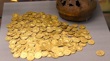
Trade in the Roman Empire - Web Quest & Map Skills
This activity has been designed to fit a 20-30-minute slot for your class and is suitable for both online and classroom teaching. Students have to do a web quest in order to complete a map. It is part of our Roman Economy and Trade...
Image
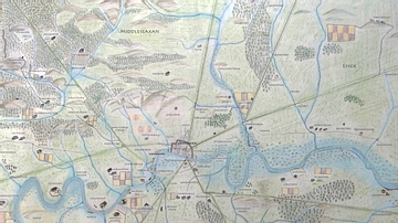
Map of Anglo-Saxon London
This is a map of Anglo-Saxon London between circa 500 CE and 1066 CE. The main purpose of this map is to highlight those place names which can still be recognized in modern London. As this map spans over 500 years, some of these places may...
Image
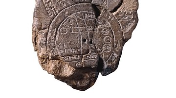
Babylonian Map of the World
Babylonian, about 700-500 BCE Probably from Sippar, southern Iraq A unique ancient map of the Mesopotamian world This tablet contains both a cuneiform inscription and a unique map of the Mesopotamian world. Babylon is shown in the...
Image
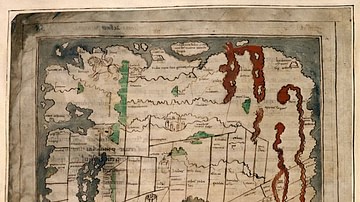
Anglo-Saxon Map of the World
The "Cotton Map" is an Anglo-Saxon map of the world produced during the 12th Century. The map is oriented with East at the top, and West at the bottom, in the style of many Medieval maps. The Anglo-Saxon map is sometimes called the "Cotton...
Image
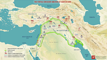
Map of the Fertile Crescent
A map of the Fertile Crescent showing the Eastern Mediterranean, Anatolia, and Mesopotamia. Key agricultural produce is shown on the map, including early cereals and animals, as well as the dates of first known agriculture.
Image
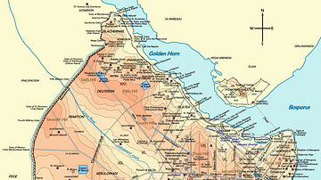
Map of Byzantine Constantinople
Topographical map of Constantinople during the Byzantine period. Main map source: R. Janin, Constantinople Byzantine. Developpement urbain et repertoire topographique. Road network and some other details based on Dumbarton Oaks Papers 54...
Image
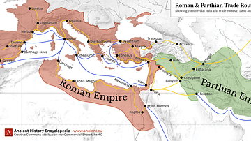
Map of Roman & Parthian Trade Routes
This map shows the Roman-Parthian trade route system, circa between the 1st and the 3rd centuries CE. During this period, the Roman Empire and the Parthian Empire were the two superpowers of the region and the Roman-Parthian trade system...
Image
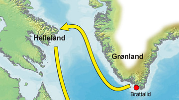
Map of the Greenland-Vinland Voyage
Map showing the reconstructed route Norse Vikings sailed in the Vinland sagas on their way to Vinland (Newfoundland, Canada), where they founded a settlement at the site of L'Anse aux Meadows. The sagas describe the Vikings first coming across...