---
title: Map of Roman Britain, 150 AD
author: Andrei nacu
source: https://www.worldhistory.org/image/575/map-of-roman-britain-150-ad/
format: machine-readable-alternate
updated: 1970-01-01
---
# Map of Roman Britain, 150 AD
_Authored by Andrei nacu_
## Image File
[](https://www.worldhistory.org/uploads/images/575.png)
## Image Caption
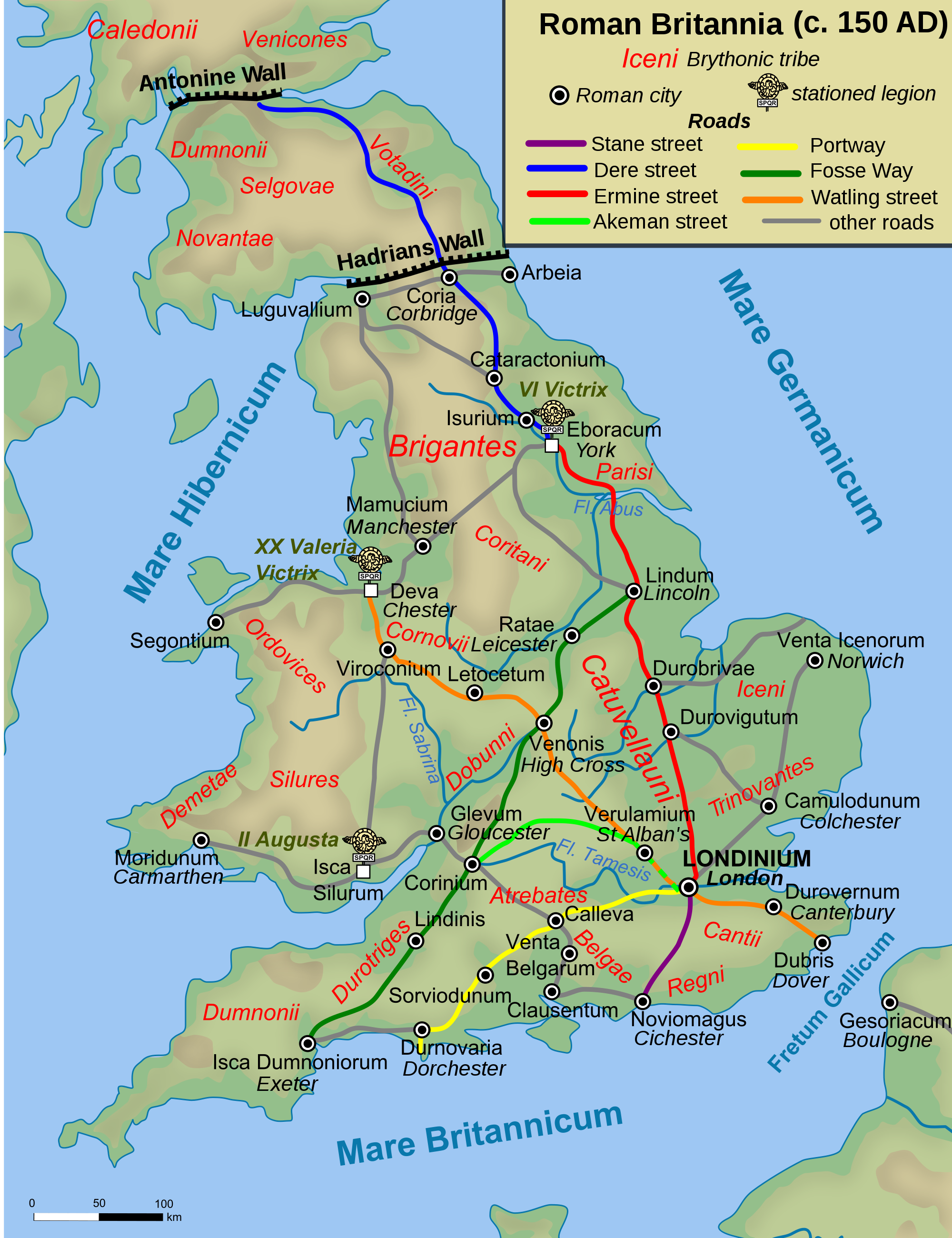
Map of [Roman Britain](https://www.worldhistory.org/Roman_Britain/) ca. 150 AD, showing the main [Roman roads](https://www.worldhistory.org/article/758/roman-roads/), [cities](https://www.worldhistory.org/city/), and Brythonic tribes.
## Cite This Work
### APA
nacu, A. (2012, April 26). Map of Roman Britain, 150 AD. *World History Encyclopedia*.
### Chicago
nacu, Andrei. "Map of Roman Britain, 150 AD." *World History Encyclopedia*, April 26, 2012. .
### MLA
nacu, Andrei. "Map of Roman Britain, 150 AD." *World History Encyclopedia*, 26 Apr 2012, .
## License & Copyright
[Original image](http://en.wikipedia.org/wiki/File:Roman_Roads_in_Britannia.svg) by [**Andrei nacu**](http://en.wikipedia.org/wiki/File:Roman_Roads_in_Britannia.svg). Submitted by [Jan van der Crabben](https://www.worldhistory.org/user/jvdc/ "User Page: Jan van der Crabben"), published on 26 April 2012. The copyright holder has published this content under the following license: [Public Domain](http://en.wikipedia.org/wiki/Public_domain). This item is in the public domain, and can be used, copied, and modified without any restrictions. Please note that content linked from this page may have different licensing terms.