---
title: Map of Machu Picchu
author: Hobe / Holger Behr
source: https://www.worldhistory.org/image/2339/map-of-machu-picchu/
format: machine-readable-alternate
updated: 1970-01-01
---
# Map of Machu Picchu
_Authored by Hobe / Holger Behr_
## Image File
[](https://www.worldhistory.org/uploads/images/2339.png)
## Image Caption
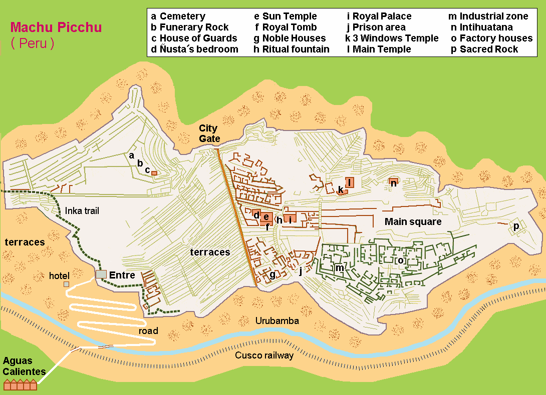
A map of [Machu Picchu](https://www.worldhistory.org/Machu_Picchu/), the [Inca](https://www.worldhistory.org/Inca_Civilization/) site in the high Andes in the Urubamba Valley. The settlement was founded by [Pachacuti Inca Yupanqui](https://www.worldhistory.org/Pachacuti_Inca_Yupanqui/) in c. 1450 CE. Typical of [Inca architecture](https://www.worldhistory.org/Inca_Architecture/), the settlement follows the contours of the natural topography.
## Cite This Work
### APA
Behr, H. /. H. (2014, March 03). Map of Machu Picchu. *World History Encyclopedia*.
### Chicago
Behr, Hobe / Holger. "Map of Machu Picchu." *World History Encyclopedia*, March 03, 2014. .
### MLA
Behr, Hobe / Holger. "Map of Machu Picchu." *World History Encyclopedia*, 03 Mar 2014, .
## License & Copyright
[Original image](http://commons.wikimedia.org/wiki/File:Karta_MachuPicchu.PNG) by [**Hobe / Holger Behr**](http://commons.wikimedia.org/wiki/File:Karta_MachuPicchu.PNG). Submitted by [Mark Cartwright](https://www.worldhistory.org/user/markzcartwright/ "User Page: Mark Cartwright"), published on 03 March 2014. The copyright holder has published this content under the following license: [Public Domain](http://en.wikipedia.org/wiki/Public_domain). This item is in the public domain, and can be used, copied, and modified without any restrictions. Please note that content linked from this page may have different licensing terms.