---
title: Map of the United States Under the Compromise of 1850
author: Simeon Netchev
source: https://www.worldhistory.org/image/20534/map-of-the-united-states-under-the-compromise-of-1/
format: machine-readable-alternate
license: Creative Commons Attribution-NonCommercial-NoDerivs (https://creativecommons.org/licenses/by-nc/4.0)
updated: 2025-06-04
---
# Map of the United States Under the Compromise of 1850
_Authored by [Simeon Netchev](https://www.worldhistory.org/user/simeonnetchev/)_
## Image File
[](https://www.worldhistory.org/uploads/images/20534.png)
## Image Caption
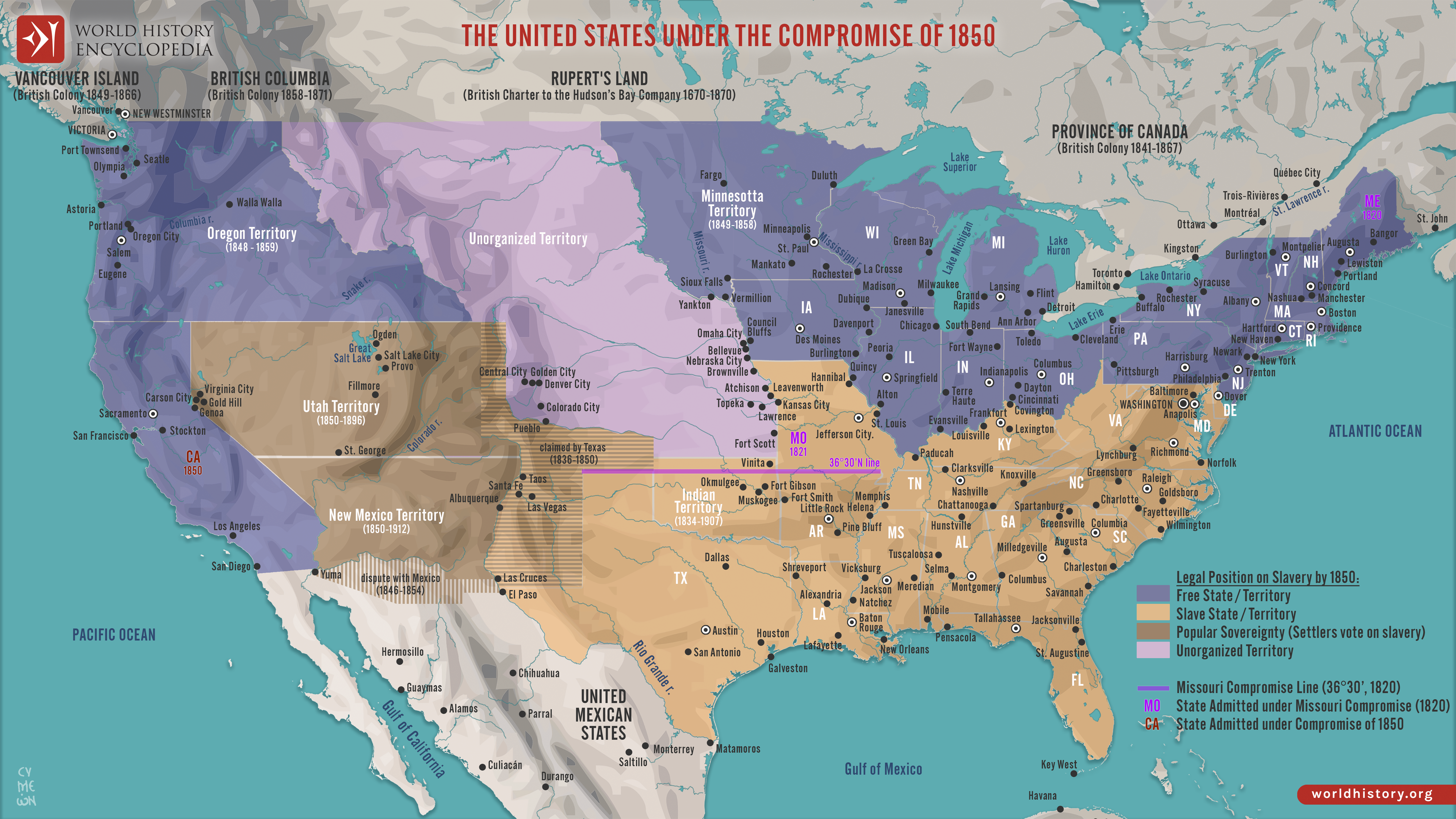
This map illustrates the situation in the United States n 1850, as the country faced growing sectional tension over the expansion of slavery into new territories gained from the [Mexican-American War](https://www.worldhistory.org/Mexican-American_War/). The [Compromise of 1850](https://www.worldhistory.org/Compromise_of_1850/) aimed to preserve the Union by balancing interests between free and slave states through a series of legislative acts.
The compromise admitted California as a free state, while allowing the territories of New Mexico and Utah to decide on slavery by popular sovereignty. It also included a stricter Fugitive Slave Act, fueling Northern resistance, and settled a border dispute in favor of Texas in exchange for federal debt relief. The slave [trade](https://www.worldhistory.org/disambiguation/trade/) was abolished in Washington, D.C., though slavery itself remained legal there. While the Compromise temporarily eased tensions, it exposed deep divisions and laid the groundwork for future conflict, showing that legislative balancing acts could no longer hold back the growing national crisis over slavery.
#### Editorial Review
This human-authored image has been reviewed by our editorial team before publication to ensure accuracy, reliability and adherence to academic standards in accordance with our [editorial policy](https://www.worldhistory.org/static/editorial-policy/).
## About the Author
Simeon is a freelance visual designer and history educator, passionate about the human stories that shape the past.
- [Linkedin Profile](https://www.linkedin.com/in/simeon-netchev/)
## Cite This Work
### APA
Netchev, S. (2025, June 04). Map of the United States Under the Compromise of 1850. *World History Encyclopedia*.
### Chicago
Netchev, Simeon. "Map of the United States Under the Compromise of 1850." *World History Encyclopedia*, June 04, 2025. .
### MLA
Netchev, Simeon. "Map of the United States Under the Compromise of 1850." *World History Encyclopedia*, 04 Jun 2025, .
## License & Copyright
Submitted by [Simeon Netchev](https://www.worldhistory.org/user/simeonnetchev/ "User Page: Simeon Netchev"), published on 04 June 2025. The copyright holder has published this content under the following license: [Creative Commons Attribution-NonCommercial-NoDerivs](https://creativecommons.org/licenses/by-nc/4.0deed.en). This licence only allows others to download this content and share it with others as long as the author is credited, but they can't change the content in any way or use it commercially. When republishing on the web a hyperlink back to the original content source URL must be included. Please note that content linked from this page may have different licensing terms.