---
title: Topographic and Military Map of Stockach and Engen: French and Austrian Positions, 1799–1800
author: Léopold Denis
source: https://www.worldhistory.org/image/20476/topographic-and-military-map-of-stockach-and-engen/
format: machine-readable-alternate
updated: 2025-05-23
---
# Topographic and Military Map of Stockach and Engen: French and Austrian Positions, 1799–1800
_Authored by [Léopold Denis](https://www.worldhistory.org/user/lopolddenis/)_
## Image File
[](https://www.worldhistory.org/uploads/images/20476.jpg)
## Image Caption
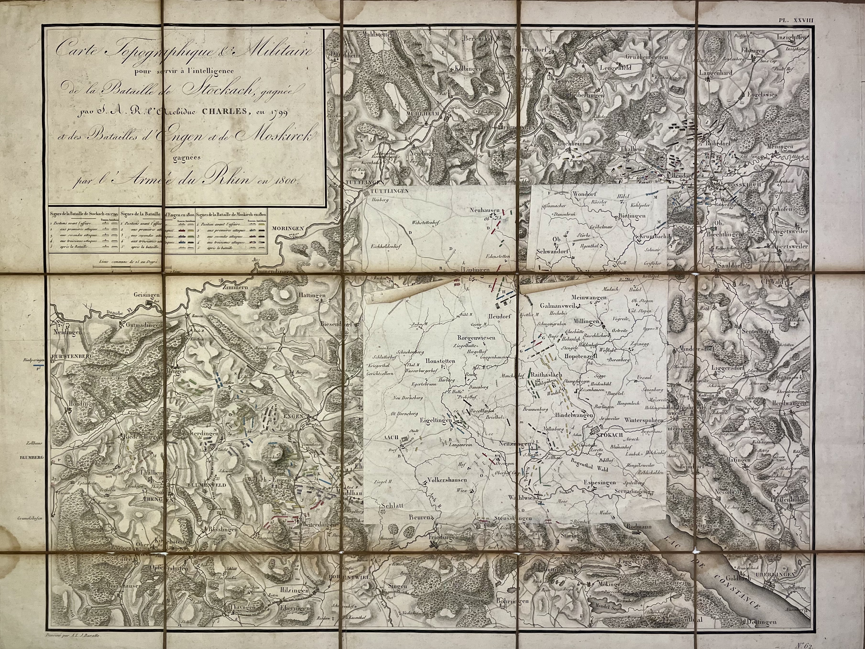
This topographic and military map was created to support the understanding of the [Battle](https://www.worldhistory.org/disambiguation/battle/) of Stockach, won by Archduke Charles in 1799, as well as the Battles of Engen and Moskirch, won by the Army of the Rhine in 1800. It presents in detail the positions of French and Austrian forces across these engagements. The map was drawn by A. L. J. Baratte. Source: [Votre Carte Ancienne – antique maps of Germany](https://carteancienne.com/en/collections/old-maps-germany).
#### Editorial Review
This human-authored image has been reviewed by our editorial team before publication to ensure accuracy, reliability and adherence to academic standards in accordance with our [editorial policy](https://www.worldhistory.org/static/editorial-policy/).
## Bibliography
- [Votre Carte Ancienne](https://carteancienne.com/ "Votre Carte Ancienne")
## About the Author
Passionate about cartography, I curate exhibitions and share rare historical maps through Votre Carte Ancienne, a platform dedicated to the beauty and heritage of antique cartography.
## Cite This Work
### APA
Denis, L. (2025, May 23). Topographic and Military Map of Stockach and Engen: French and Austrian Positions, 1799–1800. *World History Encyclopedia*.
### Chicago
Denis, Léopold. "Topographic and Military Map of Stockach and Engen: French and Austrian Positions, 1799–1800." *World History Encyclopedia*, May 23, 2025. .
### MLA
Denis, Léopold. "Topographic and Military Map of Stockach and Engen: French and Austrian Positions, 1799–1800." *World History Encyclopedia*, 23 May 2025, .
## License & Copyright
Submitted by [Léopold Denis](https://www.worldhistory.org/user/lopolddenis/ "User Page: Léopold Denis"), published on 23 May 2025. The copyright holder has published this content under the following license: [Public Domain](http://en.wikipedia.org/wiki/Public_domain). This item is in the public domain, and can be used, copied, and modified without any restrictions. Please note that content linked from this page may have different licensing terms.