---
title: Map of the Area Between the Lahn and the Sieg: Military Operations, 14–21 June 1796
author: Léopold Denis
source: https://www.worldhistory.org/image/20473/map-of-the-area-between-the-lahn-and-the-sieg/
format: machine-readable-alternate
updated: 2025-05-23
---
# Map of the Area Between the Lahn and the Sieg: Military Operations, 14–21 June 1796
_Authored by [Léopold Denis](https://www.worldhistory.org/user/lopolddenis/)_
## Image File
[](https://www.worldhistory.org/uploads/images/20473.jpg)
## Image Caption
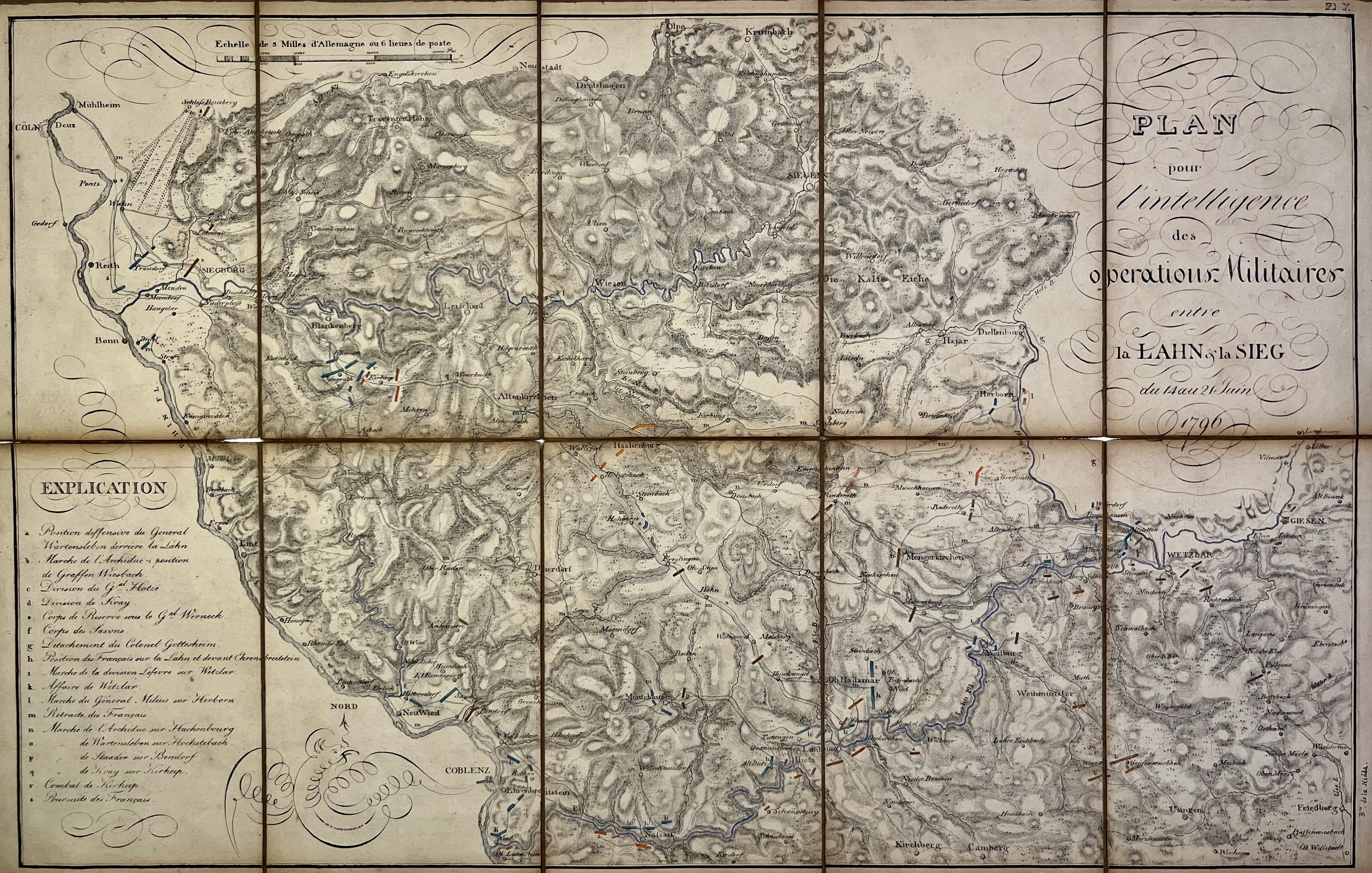
This historical map was produced to support the understanding of military operations conducted between the Lahn and Sieg rivers from 14 to 21 June 1796. It provides a geographic overview of the region during this critical phase of the campaign, serving as a valuable reference for analyzing troop movements and strategic positioning. Source: [Votre Carte Ancienne – antique maps of Germany](https://carteancienne.com/en/collections/old-maps-germany).
#### Editorial Review
This human-authored image has been reviewed by our editorial team before publication to ensure accuracy, reliability and adherence to academic standards in accordance with our [editorial policy](https://www.worldhistory.org/static/editorial-policy/).
## Bibliography
- [Votre Carte Ancienne](https://carteancienne.com/ "Votre Carte Ancienne")
## About the Author
Passionate about cartography, I curate exhibitions and share rare historical maps through Votre Carte Ancienne, a platform dedicated to the beauty and heritage of antique cartography.
## Cite This Work
### APA
Denis, L. (2025, May 23). Map of the Area Between the Lahn and the Sieg: Military Operations, 14–21 June 1796. *World History Encyclopedia*.
### Chicago
Denis, Léopold. "Map of the Area Between the Lahn and the Sieg: Military Operations, 14–21 June 1796." *World History Encyclopedia*, May 23, 2025. .
### MLA
Denis, Léopold. "Map of the Area Between the Lahn and the Sieg: Military Operations, 14–21 June 1796." *World History Encyclopedia*, 23 May 2025, .
## License & Copyright
Submitted by [Léopold Denis](https://www.worldhistory.org/user/lopolddenis/ "User Page: Léopold Denis"), published on 23 May 2025. The copyright holder has published this content under the following license: [Public Domain](http://en.wikipedia.org/wiki/Public_domain). This item is in the public domain, and can be used, copied, and modified without any restrictions. Please note that content linked from this page may have different licensing terms.