---
title: Map of Erie Canal
author: Unknown Author
source: https://www.worldhistory.org/image/20055/map-of-erie-canal/
format: machine-readable-alternate
updated: 2025-02-19
---
# Map of Erie Canal
_Authored by Unknown Author_
## Image File
[](https://www.worldhistory.org/uploads/images/20055.jpg)
## Image Caption
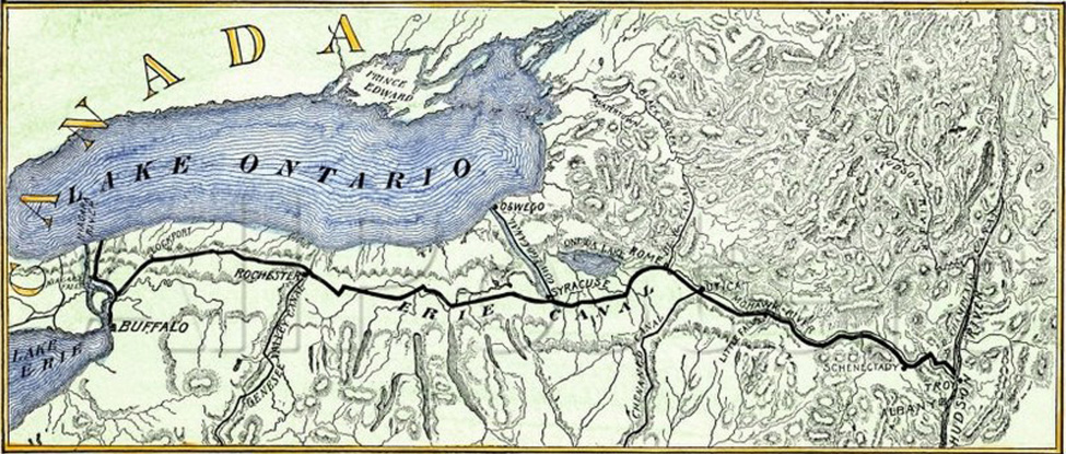
A map of Erie Canal c. 1840. The canal, constructed between 1817 and 1825, stretches 363 miles (584 km) from the Hudson River at Albany, New York, to Lake Erie at Buffalo, New York.
## Cite This Work
### APA
Author, U. (2025, February 19). Map of Erie Canal. *World History Encyclopedia*.
### Chicago
Author, Unknown. "Map of Erie Canal." *World History Encyclopedia*, February 19, 2025. .
### MLA
Author, Unknown. "Map of Erie Canal." *World History Encyclopedia*, 19 Feb 2025, .
## License & Copyright
[Original image](https://commons.wikimedia.org/wiki/File:Erie-canal_1840_map.jpg) by [**Unknown Author**](https://commons.wikimedia.org/wiki/File:Erie-canal_1840_map.jpg). Submitted by [Scarlett Hart](https://www.worldhistory.org/user/scarletthart/ "User Page: Scarlett Hart"), published on 19 February 2025. The copyright holder has published this content under the following license: [Public Domain](http://en.wikipedia.org/wiki/Public_domain). This item is in the public domain, and can be used, copied, and modified without any restrictions. Please note that content linked from this page may have different licensing terms.