
Illustration
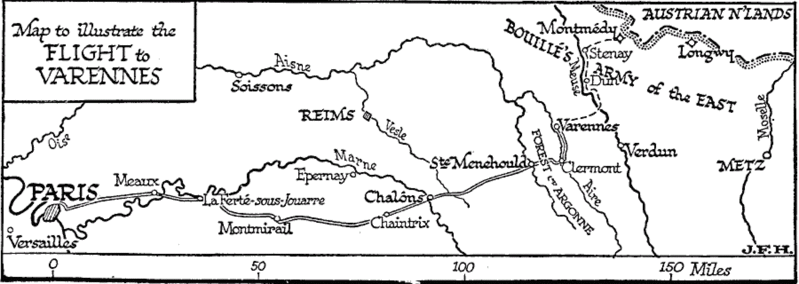
A map illustrating the route taken by King Louis XVI and his family during the failed escape from Paris known as the Flight to Varennes, on the night of 20-21 June 1791. The royal family was attempting to make it to Montmedy, on the border of the Austrian Netherlands, but was stopped and arrested at the town of Varennes-en-Argonne. From The Outline of History (New York, NY: The Macmillan Company, 1921) page 867, by H.G. Wells.
License & Copyright
 Based on Wikipedia content that has been reviewed, edited, and republished.
Original image by H.G. Wells. Uploaded by Harrison W. Mark, published on 09 August 2022. The copyright holder has published this content under the following license: Public Domain. This item is in the public domain, and can be used, copied, and modified without any restrictions. Please note that content linked from this page may have different licensing terms.
Based on Wikipedia content that has been reviewed, edited, and republished.
Original image by H.G. Wells. Uploaded by Harrison W. Mark, published on 09 August 2022. The copyright holder has published this content under the following license: Public Domain. This item is in the public domain, and can be used, copied, and modified without any restrictions. Please note that content linked from this page may have different licensing terms.
Related Images

Return of Louis XVI to Paris After Varennes

Arrest of Louis XVI and His Family in Varennes, 1791

Louis XVI Educating His Son in the Tower of the Temple

The Duke of Berry and the Count of Provence as Children

Louis XVI of France

Portrait of Louis XVI of France
Cite This Work
APA Style
Wells, H. (2022, August 09). Map to Illustrate the Flight to Varennes. World History Encyclopedia. Retrieved from https://www.worldhistory.org/image/16241/map-to-illustrate-the-flight-to-varennes/
Chicago Style
Wells, H.G.. "Map to Illustrate the Flight to Varennes." World History Encyclopedia. Last modified August 09, 2022. https://www.worldhistory.org/image/16241/map-to-illustrate-the-flight-to-varennes/.
MLA Style
Wells, H.G.. "Map to Illustrate the Flight to Varennes." World History Encyclopedia. World History Encyclopedia, 09 Aug 2022. Web. 19 Apr 2024.