---
title: Map Showing Davis Island Below the Tropic of Capricorn
author: Atlas of Mutual Heritage and the Dutch National Library
source: https://www.worldhistory.org/image/15969/map-showing-davis-island-below-the-tropic-of-capri/
format: machine-readable-alternate
updated: 1970-01-01
---
# Map Showing Davis Island Below the Tropic of Capricorn
_Authored by Atlas of Mutual Heritage and the Dutch National Library_
## Image File
[](https://www.worldhistory.org/uploads/images/15969.jpg)
## Image Caption
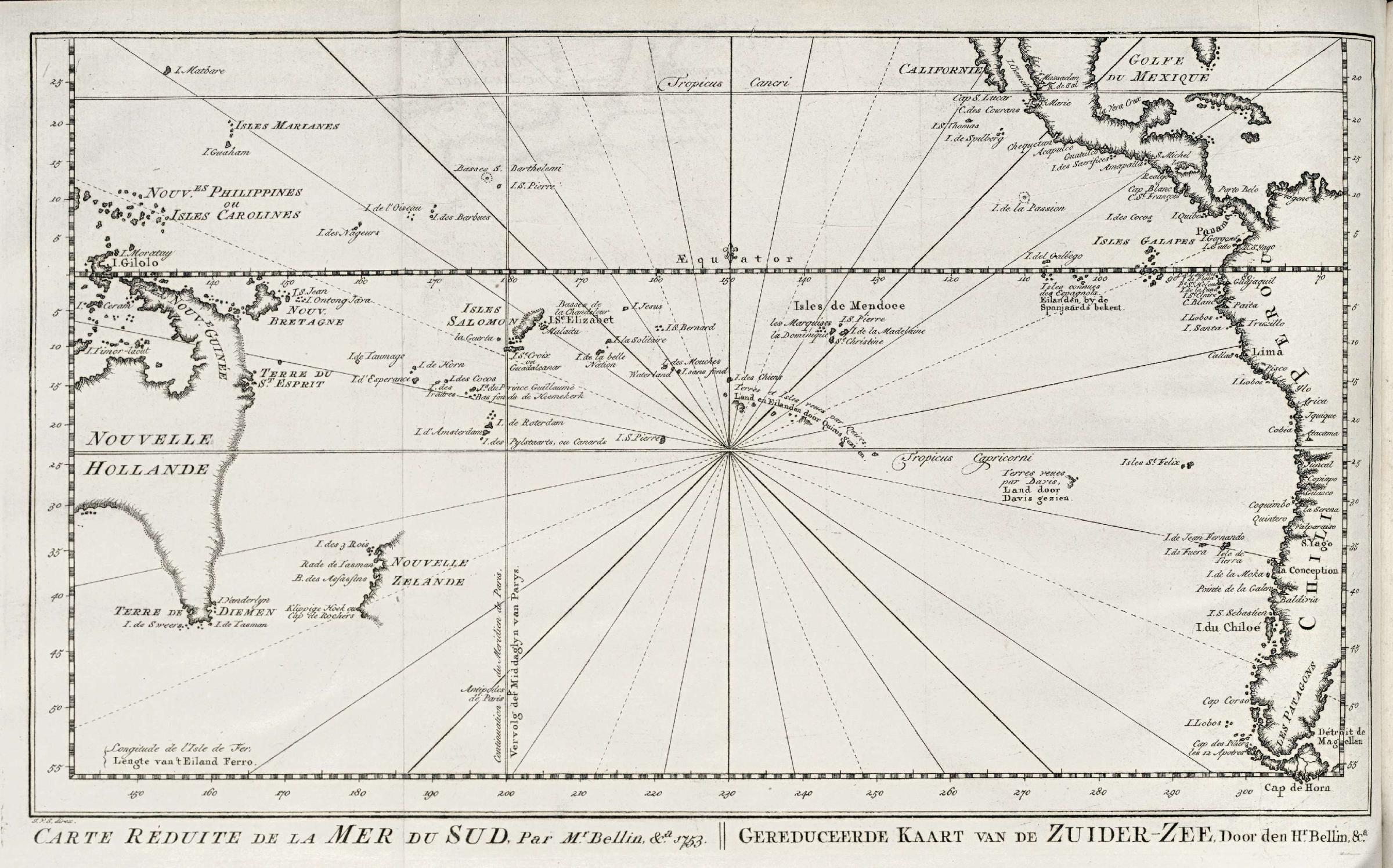
Ile Davis (Davis Island or Davis Land) was an island said to have been discovered in 1687 near Rapa Nui ([Easter](https://www.worldhistory.org/Easter/) Island) by the English [buccaneer](https://www.worldhistory.org/Buccaneer/) Edward Davis (fl. c. 1680–1688) skipper of the Bachelor’s Delight. It is located below the Tropic of Capricorn, to the left of South America and Isles St. Felix.
## Cite This Work
### APA
Library, A. o. M. H. a. t. D. N. (2022, May 30). Map Showing Davis Island Below the Tropic of Capricorn. *World History Encyclopedia*.
### Chicago
Library, Atlas of Mutual Heritage and the Dutch National. "Map Showing Davis Island Below the Tropic of Capricorn." *World History Encyclopedia*, May 30, 2022. .
### MLA
Library, Atlas of Mutual Heritage and the Dutch National. "Map Showing Davis Island Below the Tropic of Capricorn." *World History Encyclopedia*, 30 May 2022, .
## License & Copyright
[Original image](https://commons.wikimedia.org/wiki/File:AMH-8032-KB_Map_of_the_Pacific_Ocean,_with_Australia_and_the_west_coast_of_South_America.jpg) by [**Atlas of Mutual Heritage and the Dutch National Library**](https://commons.wikimedia.org/wiki/File:AMH-8032-KB_Map_of_the_Pacific_Ocean,_with_Australia_and_the_west_coast_of_South_America.jpg). Submitted by [Kim Martins](https://www.worldhistory.org/user/kim.martins/ "User Page: Kim Martins"), published on 30 May 2022. The copyright holder has published this content under the following license: [Public Domain](http://en.wikipedia.org/wiki/Public_domain). This item is in the public domain, and can be used, copied, and modified without any restrictions. Please note that content linked from this page may have different licensing terms.