---
title: Topographic map of Svalbard
author: Oona Räisänen
source: https://www.worldhistory.org/image/15092/topographic-map-of-svalbard/
format: machine-readable-alternate
license: GNU Free Documentation License (http://www.gnu.org/licenses/fdl-1.3.en.html)
updated: 1970-01-01
---
# Topographic map of Svalbard
_Authored by Oona Räisänen_
## Image File
[](https://www.worldhistory.org/uploads/images/15092.png)
## Image Caption
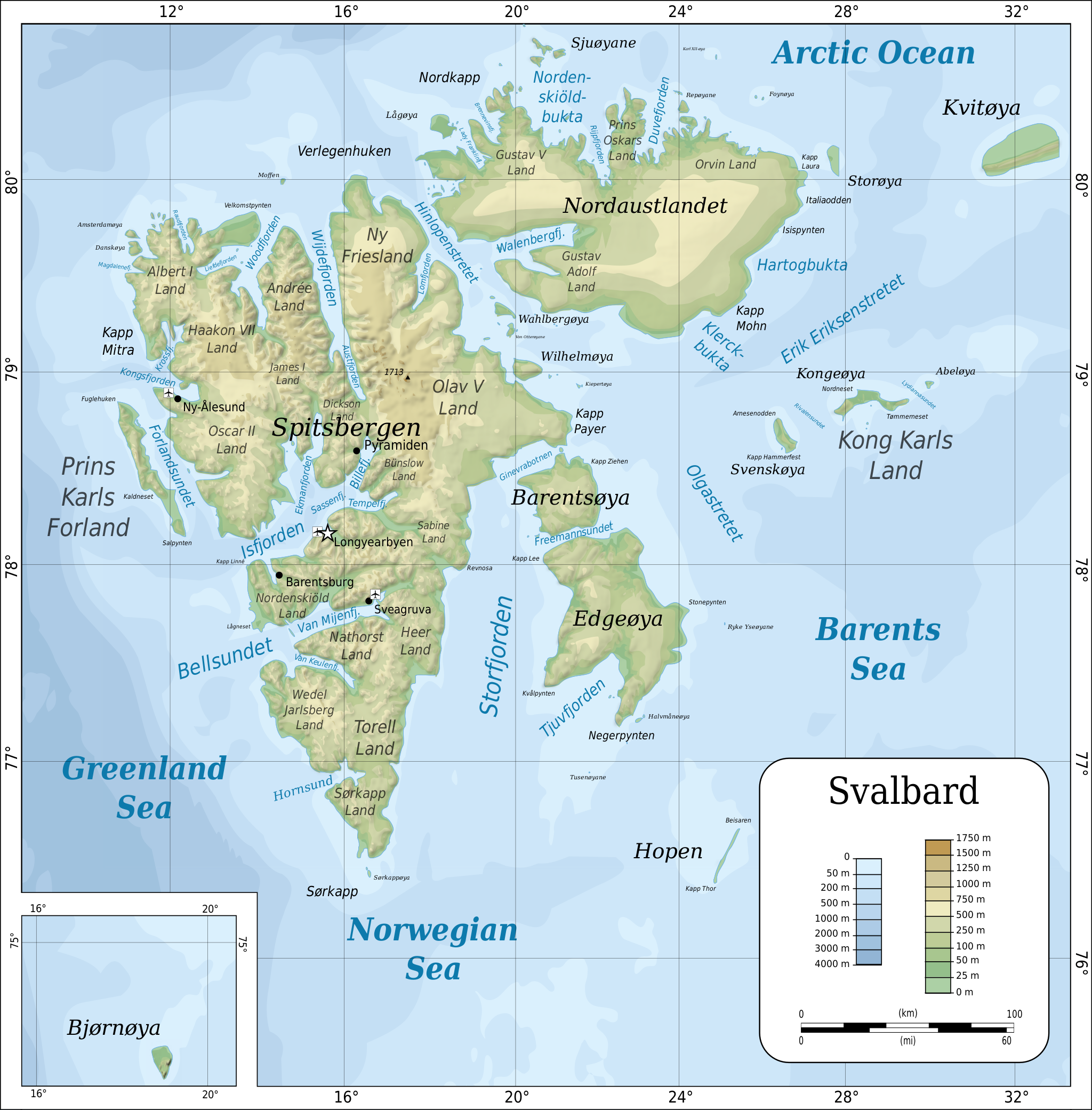
Topographic map of Svalbard archipelago (formerly known as Spitsbergen).
## Cite This Work
### APA
Räisänen, O. (2022, January 08). Topographic map of Svalbard. *World History Encyclopedia*.
### Chicago
Räisänen, Oona. "Topographic map of Svalbard." *World History Encyclopedia*, January 08, 2022. .
### MLA
Räisänen, Oona. "Topographic map of Svalbard." *World History Encyclopedia*, 08 Jan 2022, .
## License & Copyright
[Original image](https://commons.wikimedia.org/wiki/File:Topographic_map_of_Svalbard.svg) by [**Oona Räisänen**](https://commons.wikimedia.org/wiki/File:Topographic_map_of_Svalbard.svg). Submitted by [Kim Martins](https://www.worldhistory.org/user/kim.martins/ "User Page: Kim Martins"), published on 08 January 2022. The copyright holder has published this content under the following license: [GNU Free Documentation License](http://www.gnu.org/licenses/fdl-1.3.en.html). Permission is granted to copy, distribute and/or modify this document under the terms of the GNU Free Documentation License, Version 1.2 or any later version published by the Free Software Foundation; with no Invariant Sections, no Front-Cover Texts, and no Back-Cover Texts. Please note that content linked from this page may have different licensing terms.