---
title: Map of the Limes in Bavaria, Germany
author: Carole Raddato
source: https://www.worldhistory.org/image/14517/map-of-the-limes-in-bavaria-germany/
format: machine-readable-alternate
updated: 1970-01-01
---
# Map of the Limes in Bavaria, Germany
_Authored by [Carole Raddato](https://www.worldhistory.org/user/FollowingHadrian/)_
## Image File
[](https://www.worldhistory.org/uploads/images/14517.png)
## Image Caption
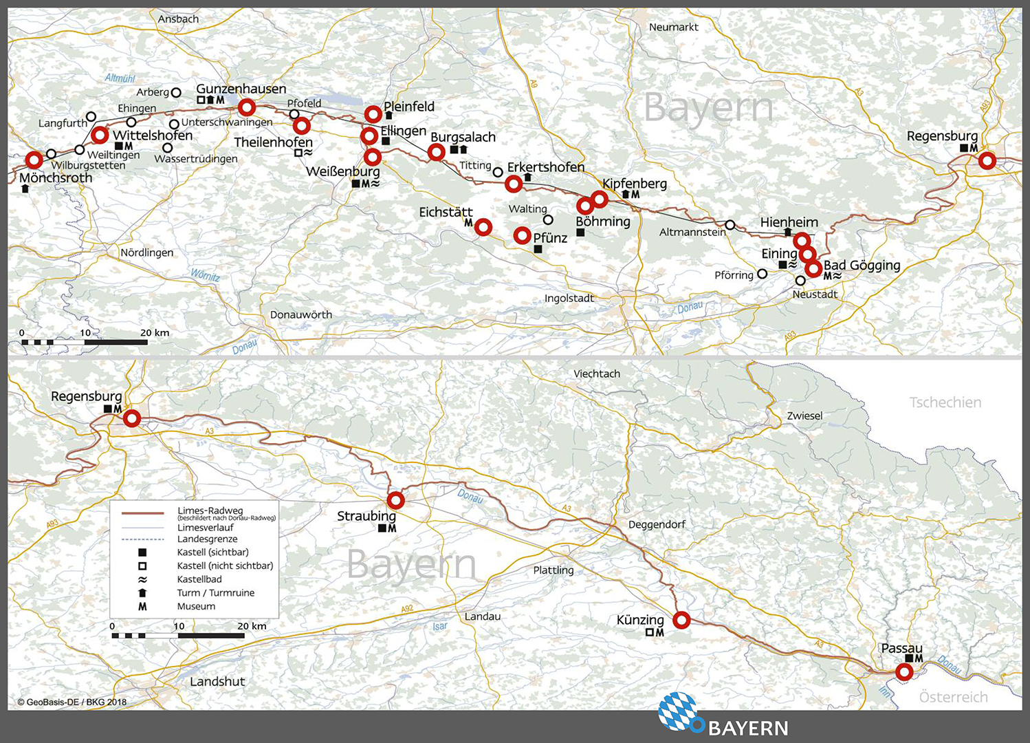
Map showing the sights along the German Limes Road (German: Deutsche Limes-Straße) in Bavaria in Germany.
The Upper German-Raetian Limes forms the frontier of the [Roman Empire](https://www.worldhistory.org/Roman_Empire/) between the rivers Rhine and Danube, and stretches 550 kilometres (342 miles). The frontier was in use from the beginning of 1st century CE to the second half of the 3rd century CE. The Upper German-Raetian Limes is part of the transnational UNESCO World Heritage Site "Frontiers of the [Roman](https://www.worldhistory.org/disambiguation/Roman/) [Empire](https://www.worldhistory.org/empire/)" together with [Hadrian's Wall](https://www.worldhistory.org/Hadrians_Wall/) and the [Antonine Wall](https://www.worldhistory.org/Antonine_Wall/).
Image courtesy of Verein Deutsche Limes-Straße (German Limes Road Association).
#### Editorial Review
This human-authored image has been reviewed by our editorial team before publication to ensure accuracy, reliability and adherence to academic standards in accordance with our [editorial policy](https://www.worldhistory.org/static/editorial-policy/).
## About the Author
Carole maintains the popular ancient history photo-blog Following Hadrian, where she travels the ancient world in the footsteps of Emperor Hadrian.
- [Facebook Profile](https://www.facebook.com/FollowingHadrian)
- [X/Twitter Profile](https://twitter.com/carolemadge)
## Cite This Work
### APA
Raddato, C. (2021, August 24). Map of the Limes in Bavaria, Germany. *World History Encyclopedia*.
### Chicago
Raddato, Carole. "Map of the Limes in Bavaria, Germany." *World History Encyclopedia*, August 24, 2021. .
### MLA
Raddato, Carole. "Map of the Limes in Bavaria, Germany." *World History Encyclopedia*, 24 Aug 2021, .
## License & Copyright
Submitted by [Carole Raddato](https://www.worldhistory.org/user/FollowingHadrian/ "User Page: Carole Raddato"), published on 24 August 2021. The copyright holder has published this content under the following license: [Copyright](http://en.wikipedia.org/wiki/Copyright). You cannot use, copy, distribute, or modify this item without explicit permission from the author. Please note that content linked from this page may have different licensing terms.