---
title: Map of New France
author: Nicolas de Fer
source: https://www.worldhistory.org/image/14479/map-of-new-france/
format: machine-readable-alternate
updated: 1970-01-01
---
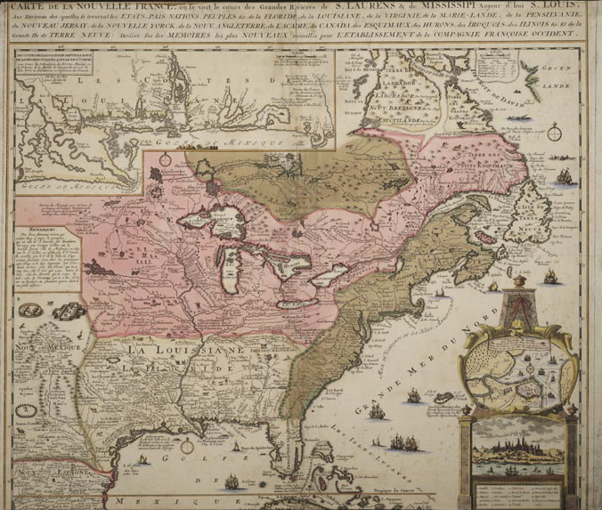
# Map of New France
_Authored by Nicolas de Fer_
## Image File
[](https://www.worldhistory.org/uploads/images/14479.jpg)
## Image Caption
A map produced in 1719 showing New France. The pink area marks the territory of Canada.
## Cite This Work
### APA
Fer, N. d. (2021, August 23). Map of New France. *World History Encyclopedia*.
### Chicago
Fer, Nicolas de. "Map of New France." *World History Encyclopedia*, August 23, 2021. .
### MLA
Fer, Nicolas de. "Map of New France." *World History Encyclopedia*, 23 Aug 2021, .
## License & Copyright
[Original image](https://en.wikipedia.org/wiki/Canada_(New_France)#/media/File:La_Nouvelle-France.jpg) by [**Nicolas de Fer**](https://en.wikipedia.org/wiki/Canada_(New_France)#/media/File:La_Nouvelle-France.jpg). Submitted by [Celina Bebenek](https://www.worldhistory.org/user/celinacyprianbe/ "User Page: Celina Bebenek"), published on 23 August 2021. The copyright holder has published this content under the following license: [Public Domain](http://en.wikipedia.org/wiki/Public_domain). This item is in the public domain, and can be used, copied, and modified without any restrictions. Please note that content linked from this page may have different licensing terms.