---
title: Map of Goa, c. 1750
author: Victorcouto
source: https://www.worldhistory.org/image/14225/map-of-goa-c-1750/
format: machine-readable-alternate
updated: 1970-01-01
---
# Map of Goa, c. 1750
_Authored by Victorcouto_
## Image File
[](https://www.worldhistory.org/uploads/images/14225.png)
## Image Caption
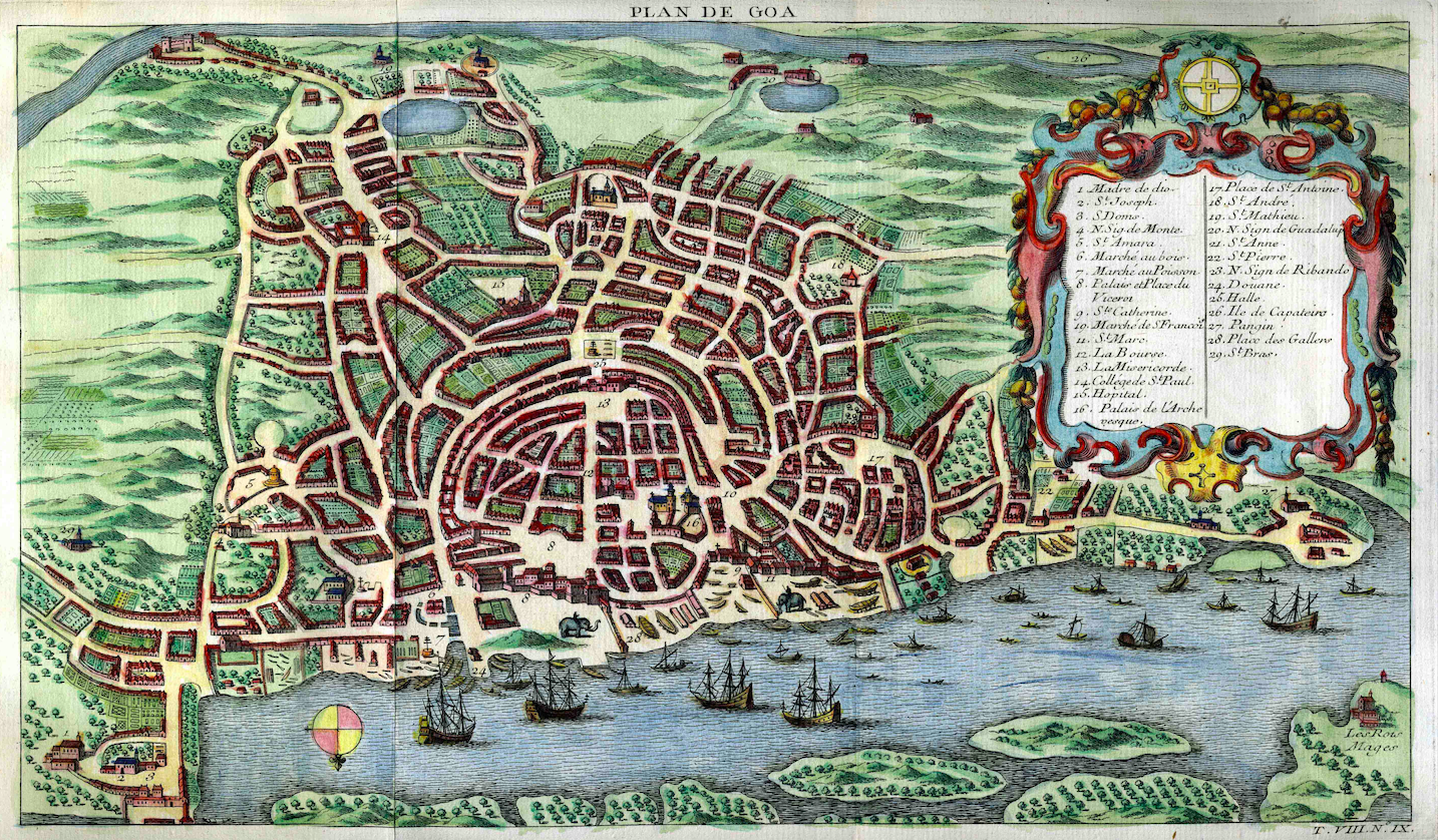
A c. 1750 map of [Portuguese Goa](https://www.worldhistory.org/Portuguese_Goa/) in [India](https://www.worldhistory.org/india/), capital of the *[Estado da India](https://www.worldhistory.org/Estado_da_India/)* or [Portuguese empire](https://www.worldhistory.org/Portuguese_Empire/) in the East.
## Cite This Work
### APA
Victorcouto. (2021, June 10). Map of Goa, c. 1750. *World History Encyclopedia*.
### Chicago
Victorcouto. "Map of Goa, c. 1750." *World History Encyclopedia*, June 10, 2021. .
### MLA
Victorcouto. "Map of Goa, c. 1750." *World History Encyclopedia*, 10 Jun 2021, .
## License & Copyright
[Original image](https://en.wikipedia.org/wiki/File:%22Plan_de_Goa%22,_in_Histoire_g%C3%A9n%C3%A9rale_des_voyages,1750.jpg) by [**Victorcouto**](https://en.wikipedia.org/wiki/File:%22Plan_de_Goa%22,_in_Histoire_g%C3%A9n%C3%A9rale_des_voyages,1750.jpg). Submitted by [Mark Cartwright](https://www.worldhistory.org/user/markzcartwright/ "User Page: Mark Cartwright"), published on 10 June 2021. The copyright holder has published this content under the following license: [Public Domain](http://en.wikipedia.org/wiki/Public_domain). This item is in the public domain, and can be used, copied, and modified without any restrictions. Please note that content linked from this page may have different licensing terms.