
Illustration
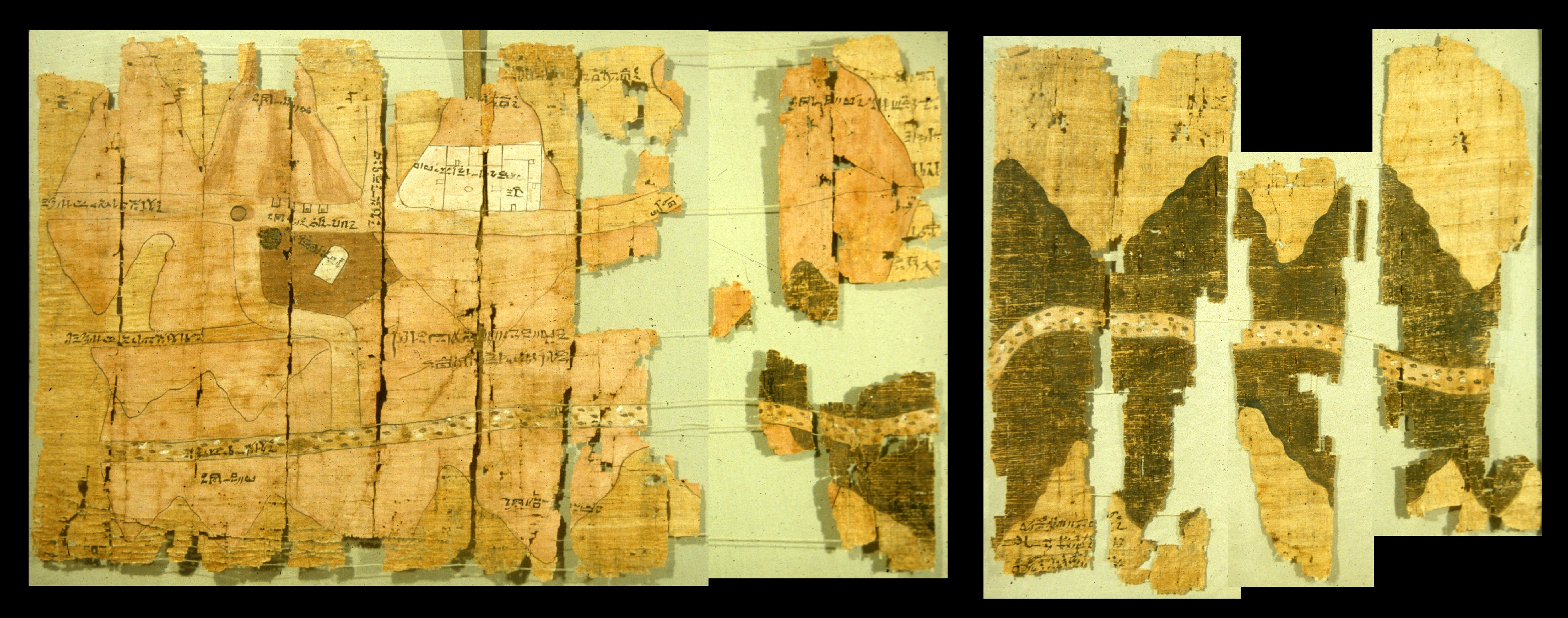
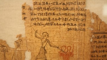
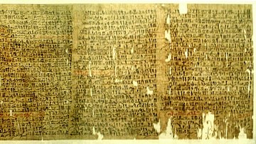
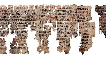
The Turin Papyrus Map is an ancient Egyptian map of gold mines in the Eastern Desert. It is considered to be one of the oldest surviving topographical maps. Made c. 1150 BCE by Scribe-of-the-Tomb Amennakhte, son of Ipuy. (Turin Museum)
License & Copyright
 Based on Wikipedia content that has been reviewed, edited, and republished.
Original image by Zyzzy. Uploaded by Arienne King, published on 30 May 2021. The copyright holder has published this content under the following license: Public Domain. This item is in the public domain, and can be used, copied, and modified without any restrictions. Please note that content linked from this page may have different licensing terms.
Based on Wikipedia content that has been reviewed, edited, and republished.
Original image by Zyzzy. Uploaded by Arienne King, published on 30 May 2021. The copyright holder has published this content under the following license: Public Domain. This item is in the public domain, and can be used, copied, and modified without any restrictions. Please note that content linked from this page may have different licensing terms.
Related Images
Market Scene
Child Pulling Coal in a Mine
Edwin Smith Papyrus
Book of the Dead Papyrus
The Westcar Papyrus
The London Medical Papyrus
Cite This Work
APA Style
Zyzzy, . (2021, May 30). Turin Papyrus Map. World History Encyclopedia. Retrieved from https://www.worldhistory.org/image/14135/turin-papyrus-map/
Chicago Style
Zyzzy, . "Turin Papyrus Map." World History Encyclopedia. Last modified May 30, 2021. https://www.worldhistory.org/image/14135/turin-papyrus-map/.
MLA Style
Zyzzy, . "Turin Papyrus Map." World History Encyclopedia. World History Encyclopedia, 30 May 2021. Web. 18 Apr 2024.