---
title: Gangnido
author: Kim Sahyung, Lee Moo, Lee Hui
source: https://www.worldhistory.org/image/14130/gangnido/
format: machine-readable-alternate
updated: 1970-01-01
---
# Gangnido
_Authored by Kim Sahyung, Lee Moo, Lee Hui_
## Image File
[](https://www.worldhistory.org/uploads/images/14130.jpg)
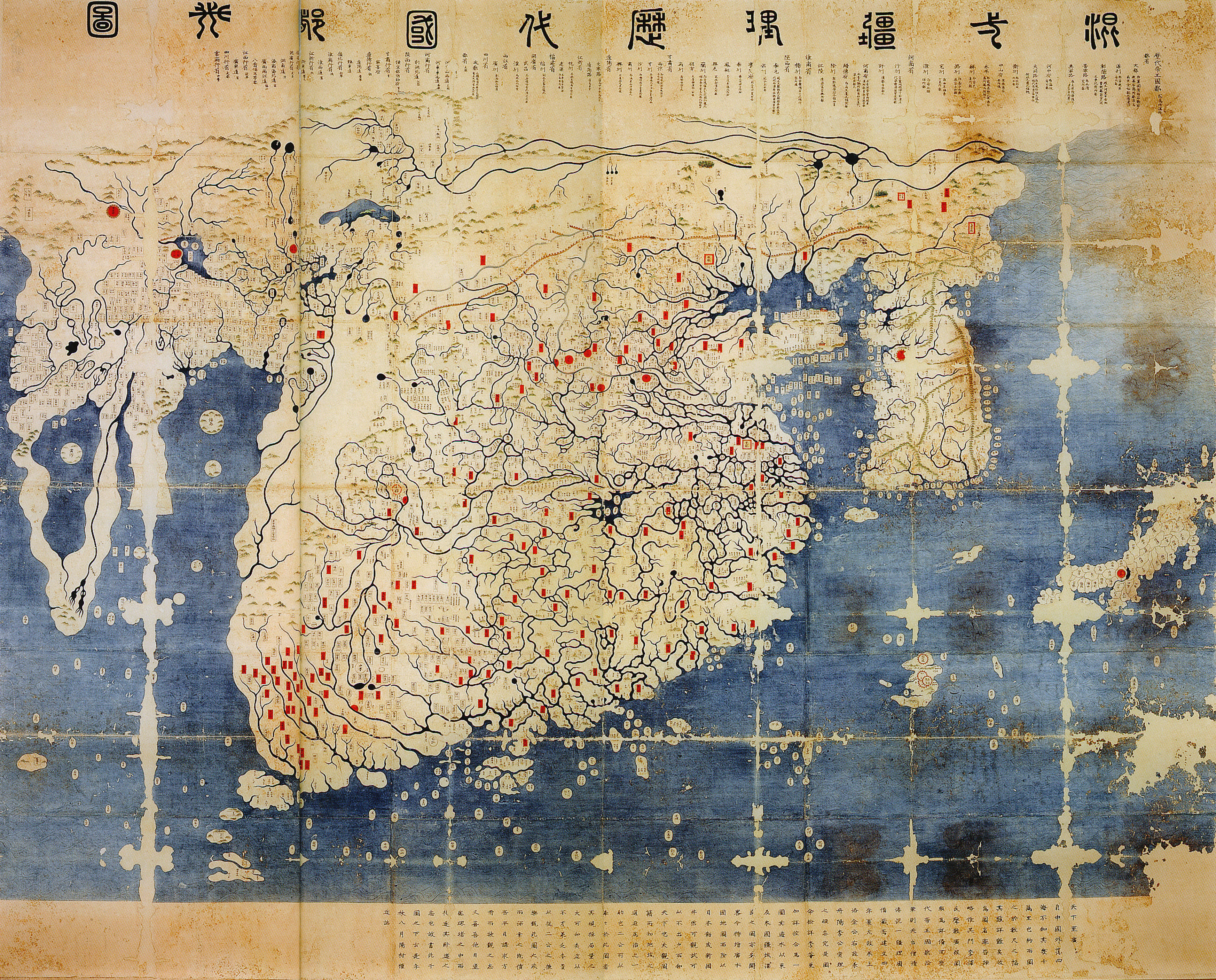
## Image Caption
The Gangnido (or Kangnido) is a world map created in [Korea](https://www.worldhistory.org/Korea/) in 1402. This version of the map was created in [Japan](https://www.worldhistory.org/disambiguation/Japan/) during the [Edo Period](https://www.worldhistory.org/Edo_Period/), and differs from the original. It is called the Honkōji copy, after the Honkōji [temple](https://www.worldhistory.org/temple/) it was discovered in. 220 cm (86.6 in) x 280 cm (110 in). Paint on paper.
## Cite This Work
### APA
Hui, K. S. L. M. L. (2021, May 30). Gangnido. *World History Encyclopedia*.
### Chicago
Hui, Kim Sahyung, Lee Moo, Lee. "Gangnido." *World History Encyclopedia*, May 30, 2021. .
### MLA
Hui, Kim Sahyung, Lee Moo, Lee. "Gangnido." *World History Encyclopedia*, 30 May 2021, .
## License & Copyright
[Original image](https://en.wikipedia.org/wiki/File:GeneralMapOfDistancesAndHistoricCapitals.jpg) by [**Kim Sahyung, Lee Moo, Lee Hui**](https://en.wikipedia.org/wiki/File:GeneralMapOfDistancesAndHistoricCapitals.jpg). Submitted by [Arienne King](https://www.worldhistory.org/user/ava.spartan.117/ "User Page: Arienne King"), published on 30 May 2021. The copyright holder has published this content under the following license: [Public Domain](http://en.wikipedia.org/wiki/Public_domain). This item is in the public domain, and can be used, copied, and modified without any restrictions. Please note that content linked from this page may have different licensing terms.