---
title: Psalter World Map
author: British Library
source: https://www.worldhistory.org/image/14126/psalter-world-map/
format: machine-readable-alternate
updated: 1970-01-01
---
# Psalter World Map
_Authored by British Library_
## Image File
[](https://www.worldhistory.org/uploads/images/14126.jpg)
## Image Caption
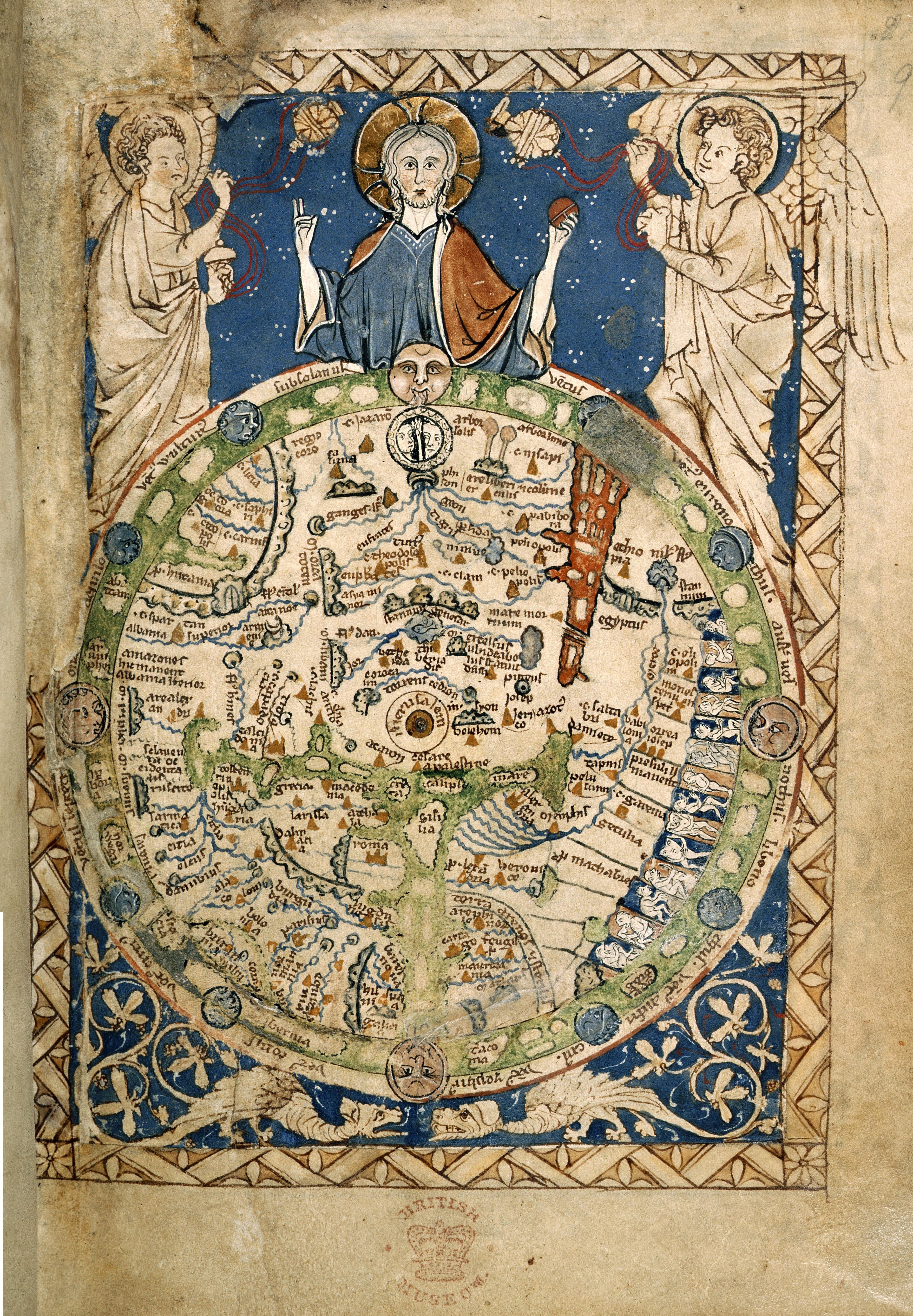
The "Psalter World Map" was made c. 1265, and depicts the world as it was known to Medieval Europeans. Approx. 9.5 cm (3.7 in) high. (Courtesy of the British Library)
## Cite This Work
### APA
Library, B. (2021, May 30). Psalter World Map. *World History Encyclopedia*.
### Chicago
Library, British. "Psalter World Map." *World History Encyclopedia*, May 30, 2021. .
### MLA
Library, British. "Psalter World Map." *World History Encyclopedia*, 30 May 2021, .
## License & Copyright
[Original image](https://commons.wikimedia.org/wiki/File:Psalter_World_Map,_c.1265.jpg) by [**British Library**](https://commons.wikimedia.org/wiki/File:Psalter_World_Map,_c.1265.jpg). Submitted by [Arienne King](https://www.worldhistory.org/user/ava.spartan.117/ "User Page: Arienne King"), published on 30 May 2021. The copyright holder has published this content under the following license: [Public Domain](http://en.wikipedia.org/wiki/Public_domain). This item is in the public domain, and can be used, copied, and modified without any restrictions. Please note that content linked from this page may have different licensing terms.