---
title: Anglo-Saxon Map of the World
author: British Library
source: https://www.worldhistory.org/image/14124/anglo-saxon-map-of-the-world/
format: machine-readable-alternate
updated: 1970-01-01
---
# Anglo-Saxon Map of the World
_Authored by British Library_
## Image File
[](https://www.worldhistory.org/uploads/images/14124.png)
## Image Caption
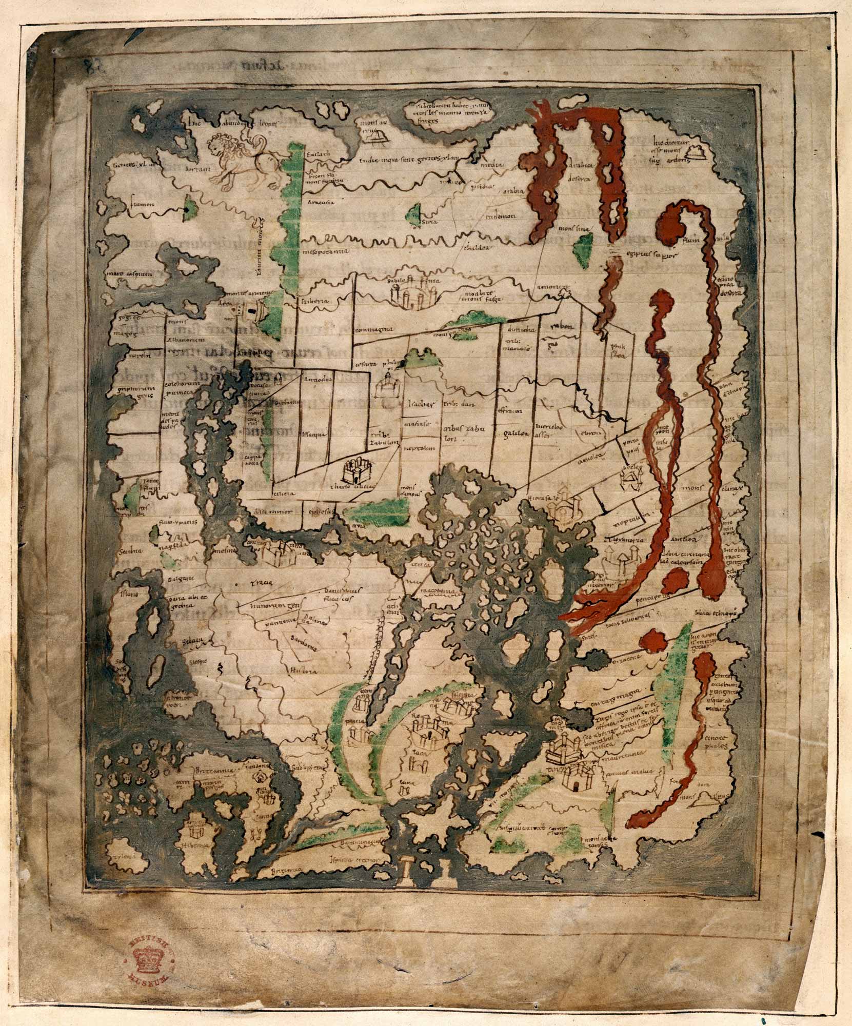
The "Cotton Map" is an Anglo-[Saxon](https://www.worldhistory.org/Saxons/) map of the world produced during the 12th Century. The map is oriented with East at the top, and West at the bottom, in the style of many Medieval maps. The Anglo-Saxon map is sometimes called the "Cotton Map" after Cotton MS [Tiberius](https://www.worldhistory.org/Tiberius/) B.V., the manuscript in which it is drawn. (Courtesy of the British Library)
## Cite This Work
### APA
Library, B. (2021, May 30). Anglo-Saxon Map of the World. *World History Encyclopedia*.
### Chicago
Library, British. "Anglo-Saxon Map of the World." *World History Encyclopedia*, May 30, 2021. .
### MLA
Library, British. "Anglo-Saxon Map of the World." *World History Encyclopedia*, 30 May 2021, .
## License & Copyright
[Original image](https://www.bl.uk/collection-items/anglo-saxon-world-map) by **British Library**. Submitted by [Arienne King](https://www.worldhistory.org/user/ava.spartan.117/ "User Page: Arienne King"), published on 30 May 2021. The copyright holder has published this content under the following license: [Public Domain](http://en.wikipedia.org/wiki/Public_domain). This item is in the public domain, and can be used, copied, and modified without any restrictions. Please note that content linked from this page may have different licensing terms.