
Illustration
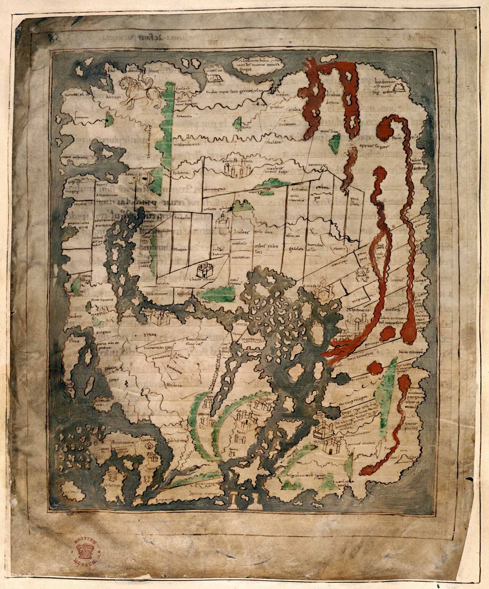
The "Cotton Map" is an Anglo-Saxon map of the world produced during the 12th Century. The map is oriented with East at the top, and West at the bottom, in the style of many Medieval maps. The Anglo-Saxon map is sometimes called the "Cotton Map" after Cotton MS Tiberius B.V., the manuscript in which it is drawn. (Courtesy of the British Library)
Related Images
Royal House of Hanover in Britain Family Tree

Air Chief Marshall Hugh Dowding
Chain Home Radar Towers
Germanic Warriors with Captured Soldiers

Medieval Soldiers in the Mud
Observer Corps Members Sighting Enemy Aircraft
Cite This Work
APA Style
Library, B. (2021, May 30). Anglo-Saxon Map of the World. World History Encyclopedia. Retrieved from https://www.worldhistory.org/image/14124/anglo-saxon-map-of-the-world/
Chicago Style
Library, British. "Anglo-Saxon Map of the World." World History Encyclopedia. Last modified May 30, 2021. https://www.worldhistory.org/image/14124/anglo-saxon-map-of-the-world/.
MLA Style
Library, British. "Anglo-Saxon Map of the World." World History Encyclopedia. World History Encyclopedia, 30 May 2021. Web. 24 Apr 2024.