
Illustration
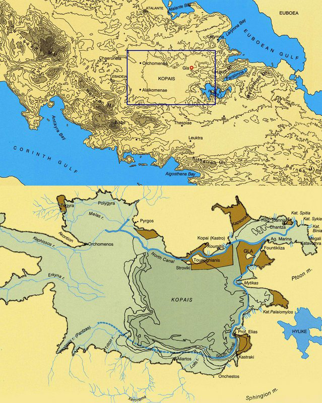
Maps of Boeotia (top) and Lake Copais (bottom). Photo © Antonia Stamos after Iakovidis, Gla and the Kopais in the 13th century BCE. (2001).
Related Images
Image
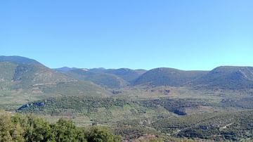
A Valley at Boeotia
The landscape of Boeotia, Greece during the spring from the monastery...
Image
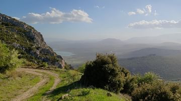
The Landscape of Akraiphnion, Boeotia
The view from the hilltops of Mt. Ptoion in Boeotia, Greece.
Image
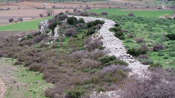
Fortifications at Gla
The northwest part of the fortification or circuit wall at Gla...
Image
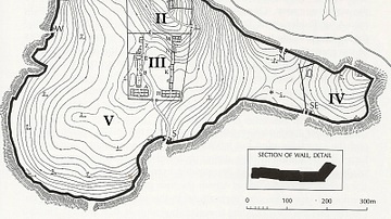
Palatial-type Structures at the Citadel of Gla
Palatial-type structures at the Citadel of Gla. Photo © Antonia...
Image
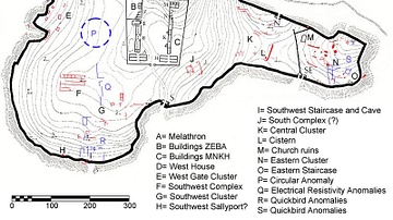
Recently Revealed Structures at the Citadel of Gla
Recently revealed structures (red) at the Citadel of Gla Photo...
Image
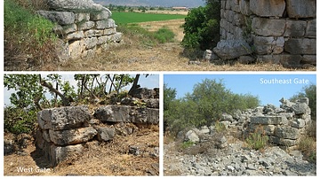
Three Gates at the Citadel of Gla
Three gates at the Mycenaean citadel of Gla, Greece, built c. 13th...
Cite This Work
APA Style
Stamos, A. (2021, February 09). Maps of Boeotia, Lake Copais, Gla & Orchomenos. World History Encyclopedia. Retrieved from https://www.worldhistory.org/image/13384/maps-of-boeotia-lake-copais-gla--orchomenos/
Chicago Style
Stamos, Antonia. "Maps of Boeotia, Lake Copais, Gla & Orchomenos." World History Encyclopedia. Last modified February 09, 2021. https://www.worldhistory.org/image/13384/maps-of-boeotia-lake-copais-gla--orchomenos/.
MLA Style
Stamos, Antonia. "Maps of Boeotia, Lake Copais, Gla & Orchomenos." World History Encyclopedia. World History Encyclopedia, 09 Feb 2021. Web. 24 Apr 2024.