
Illustration
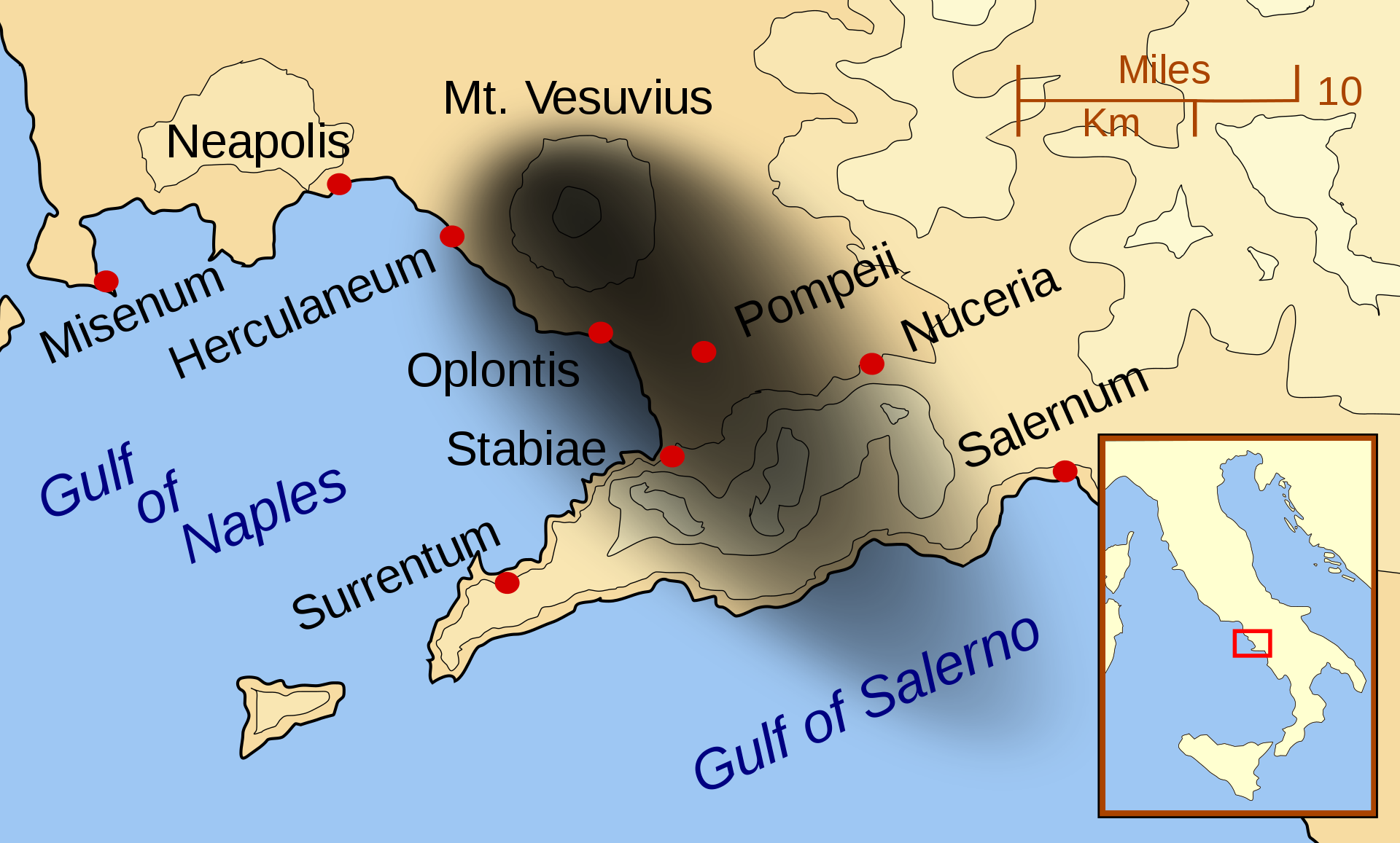
A map showing the cities and towns affected by the eruption of Mount Vesuvius in 79 CE. Date of map is 2007 CE.
License & Copyright
 Based on Wikipedia content that has been reviewed, edited, and republished.
Original image by MapMaster. Uploaded by Carole Raddato, published on 17 May 2020. The copyright holder has published this content under the following license: Creative Commons Attribution-ShareAlike. This license lets others remix, tweak, and build upon a work even for commercial reasons, as long as they credit the author and license their new creations under the identical terms. When republishing on the web a hyperlink back to the original content source URL must be included. Please note that content linked from this page may have different licensing terms.
Based on Wikipedia content that has been reviewed, edited, and republished.
Original image by MapMaster. Uploaded by Carole Raddato, published on 17 May 2020. The copyright holder has published this content under the following license: Creative Commons Attribution-ShareAlike. This license lets others remix, tweak, and build upon a work even for commercial reasons, as long as they credit the author and license their new creations under the identical terms. When republishing on the web a hyperlink back to the original content source URL must be included. Please note that content linked from this page may have different licensing terms.
Related Images

Phrixus and Helle, Mural from Pompeii

Fresco of Perseus Releasing Andromeda

Fresco of Eros Punished in the Presence of Aphrodite

Reconstruction of the Villa dei Papyri
Massachusetts Bay Colony Plaque

The Wolf Den by Elodie Harper
Cite This Work
APA Style
MapMaster, . (2020, May 17). Map of the Bay of Naples, 79 CE. World History Encyclopedia. Retrieved from https://www.worldhistory.org/image/12255/map-of-the-bay-of-naples-79-ce/
Chicago Style
MapMaster, . "Map of the Bay of Naples, 79 CE." World History Encyclopedia. Last modified May 17, 2020. https://www.worldhistory.org/image/12255/map-of-the-bay-of-naples-79-ce/.
MLA Style
MapMaster, . "Map of the Bay of Naples, 79 CE." World History Encyclopedia. World History Encyclopedia, 17 May 2020. Web. 24 Apr 2024.