---
title: Map of Amarna, Egypt
author: P.S.Docherty / Amarna3D Project
source: https://www.worldhistory.org/image/12167/map-of-amarna-egypt/
format: machine-readable-alternate
updated: 1970-01-01
---
# Map of Amarna, Egypt
_Authored by P.S.Docherty / Amarna3D Project_
## Image File
[](https://www.worldhistory.org/uploads/images/12167.jpg)
## Image Caption
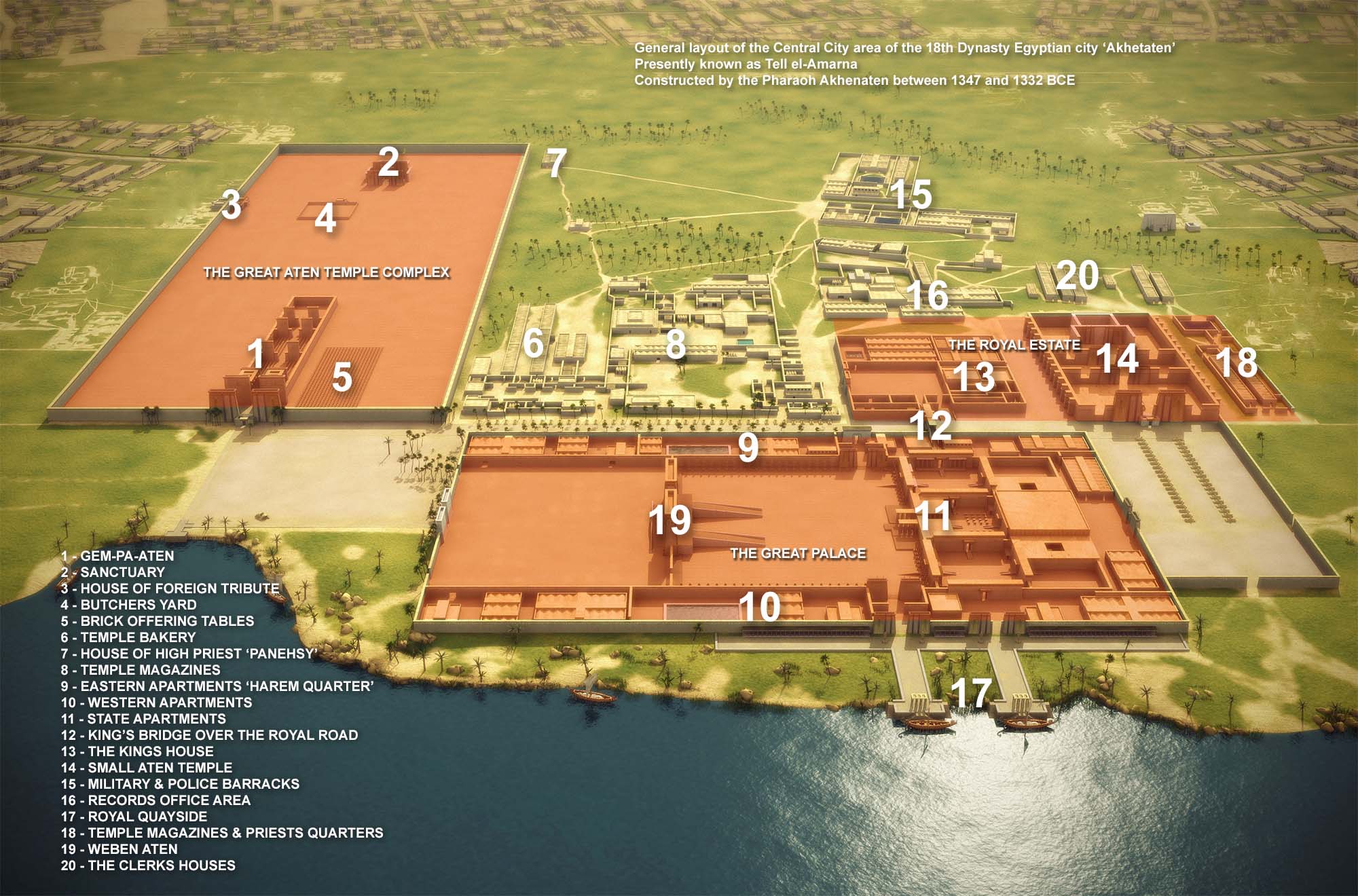
Map showing the general layout of the central [city](https://www.worldhistory.org/city/) area of the 18th Dynasty [Egyptian](https://www.worldhistory.org/disambiguation/Egyptian/) city "Akhetaten", presently known as Tell el-[Amarna](https://www.worldhistory.org/Amarna/), constructed by the [Pharaoh](https://www.worldhistory.org/pharaoh/) [Akhenaten](https://www.worldhistory.org/Akhenaten/) between 1347 and 1332 BCE. Copyright, republished with permission from the author.
## Cite This Work
### APA
Project, P. /. A. (2020, May 19). Map of Amarna, Egypt. *World History Encyclopedia*.
### Chicago
Project, P.S.Docherty / Amarna3D. "Map of Amarna, Egypt." *World History Encyclopedia*, May 19, 2020. .
### MLA
Project, P.S.Docherty / Amarna3D. "Map of Amarna, Egypt." *World History Encyclopedia*, 19 May 2020, .
## License & Copyright
[Original image](http://www.amarna3d.com/) by **P.S.Docherty / Amarna3D Project**. Submitted by [Jan van der Crabben](https://www.worldhistory.org/user/jvdc/ "User Page: Jan van der Crabben"), published on 19 May 2020. The copyright holder has published this content under the following license: [Copyright](http://en.wikipedia.org/wiki/Copyright). You cannot use, copy, distribute, or modify this item without explicit permission from the author. Please note that content linked from this page may have different licensing terms.