---
title: Map of Aghlabid Emirate
author: LuzLuz31
source: https://www.worldhistory.org/image/12006/map-of-aghlabid-emirate/
format: machine-readable-alternate
license: Creative Commons Attribution-ShareAlike (https://creativecommons.org/licenses/by-sa/4.0)
updated: 1970-01-01
---
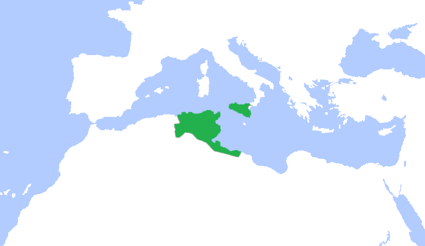
# Map of Aghlabid Emirate
_Authored by LuzLuz31_
## Image File
[](https://www.worldhistory.org/uploads/images/12006.png)
## Image Caption
This is a map showing the greatest extent of the Aghlabids (800-909 CE).
## Cite This Work
### APA
LuzLuz31. (2020, March 18). Map of Aghlabid Emirate. *World History Encyclopedia*.
### Chicago
LuzLuz31. "Map of Aghlabid Emirate." *World History Encyclopedia*, March 18, 2020. .
### MLA
LuzLuz31. "Map of Aghlabid Emirate." *World History Encyclopedia*, 18 Mar 2020, .
## License & Copyright
[Original image](https://commons.wikimedia.org/wiki/File:Aghlabid_in_900_ad.png) by [**LuzLuz31**](https://commons.wikimedia.org/wiki/File:Aghlabid_in_900_ad.png). Submitted by [Syed Muhammad Khan](https://www.worldhistory.org/user/syedmuhammadkhan21/ "User Page: Syed Muhammad Khan"), published on 18 March 2020. The copyright holder has published this content under the following license: [Creative Commons Attribution-ShareAlike](https://creativecommons.org/licenses/by-sa/4.0deed.en). This license lets others remix, tweak, and build upon a work even for commercial reasons, as long as they credit the author and license their new creations under the identical terms. When republishing on the web a hyperlink back to the original content source URL must be included. Please note that content linked from this page may have different licensing terms.