
Illustration
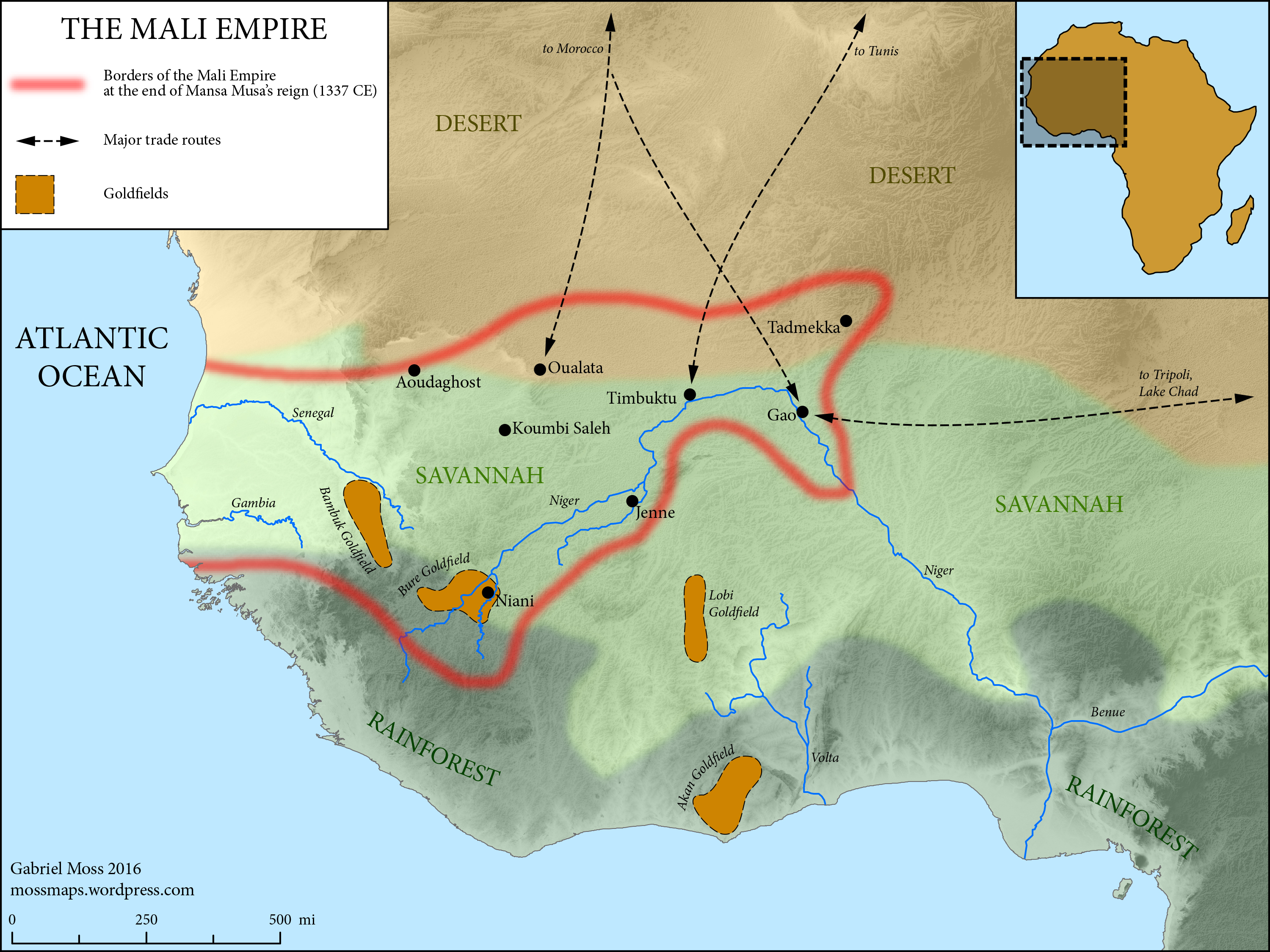
A map of the Mali Empire (1240-1645 CE) at its peak c. 1337 CE after the reign of Mansa Musa (1312-1337 CE).
Related Images
Image
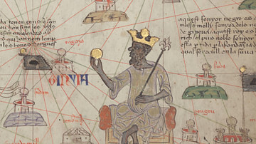
Mansa Musa of the Mali Empire
A 1375 CE illustration of Mansa Kanku Musa (r. 1312-1337 CE) who...
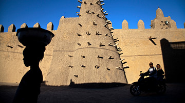
Image
Sankore Mosque, Timbuktu
The Sankore Mosque, Timbuktu, Mali. The mosque, made from pounded...

Image
Mansa Musa Illustration
A modern artist's impression of the Mali Empire ruler Mansa Musa...
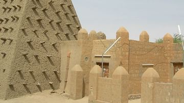
Image
Djinguereber Mosque, Timbuktu
The Djinguereber Mosque, Timbuktu, Mali. The mosque, made from...
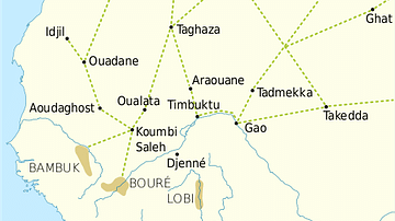
Image
Trans-Saharan Trade Routes
A map indicating the major trans-Saharan trade routes across West...
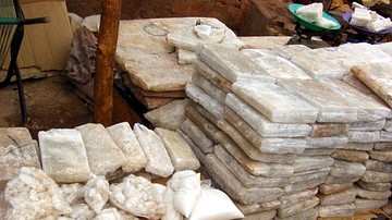
Image
Salt Slabs, Timbuktu
Salt slabs on sale at a market in Timbuktu, Mali. Salt from mines...
Cite This Work
APA Style
Moss, G. (2019, February 20). Map of the Mali Empire, c. 1337 CE. World History Encyclopedia. Retrieved from https://www.worldhistory.org/image/10129/map-of-the-mali-empire-c-1337-ce/
Chicago Style
Moss, Gabriel. "Map of the Mali Empire, c. 1337 CE." World History Encyclopedia. Last modified February 20, 2019. https://www.worldhistory.org/image/10129/map-of-the-mali-empire-c-1337-ce/.
MLA Style
Moss, Gabriel. "Map of the Mali Empire, c. 1337 CE." World History Encyclopedia. World History Encyclopedia, 20 Feb 2019. Web. 18 Apr 2024.